-
Fig 1: Gonyaulax polygramma Schematic diagram (ventral view) redrawn from Tomas et al. 1997.
-
Goniodoma acuminatum.
-
Two cells, two faces.
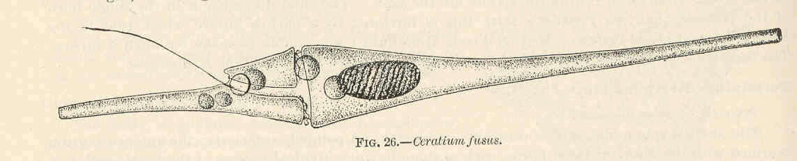
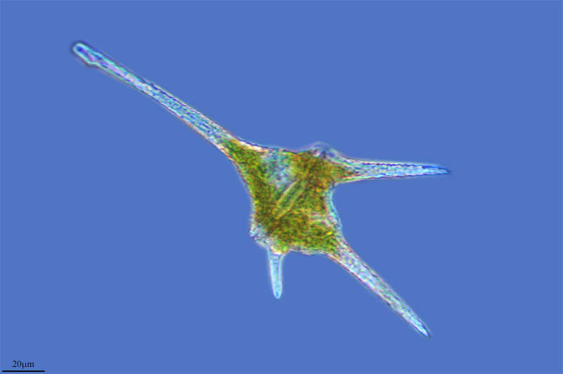
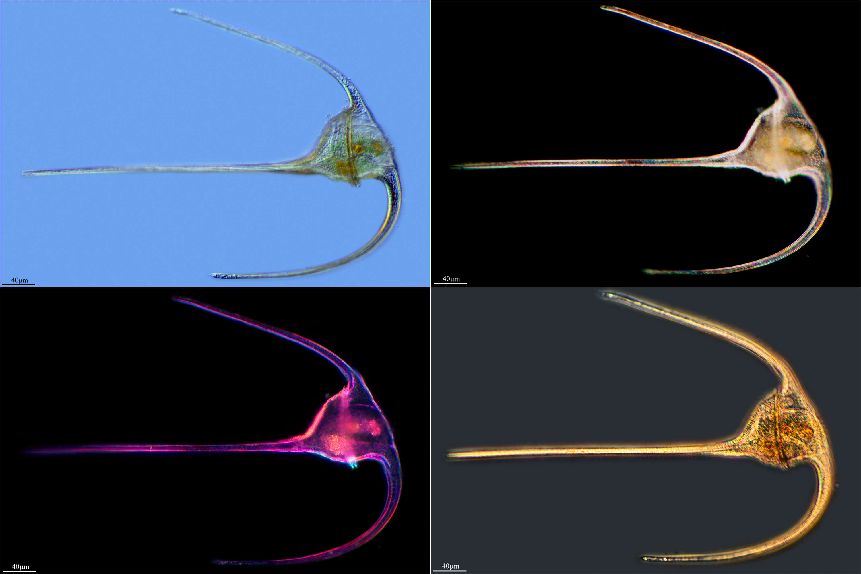
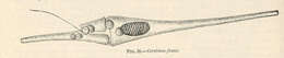
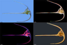
-
Ceratium fusus.
-
Ribadelago, Castille and Leon, Spain
-
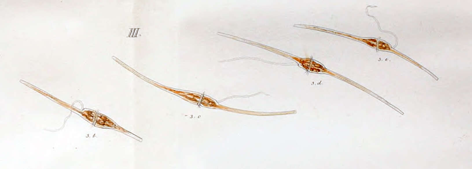
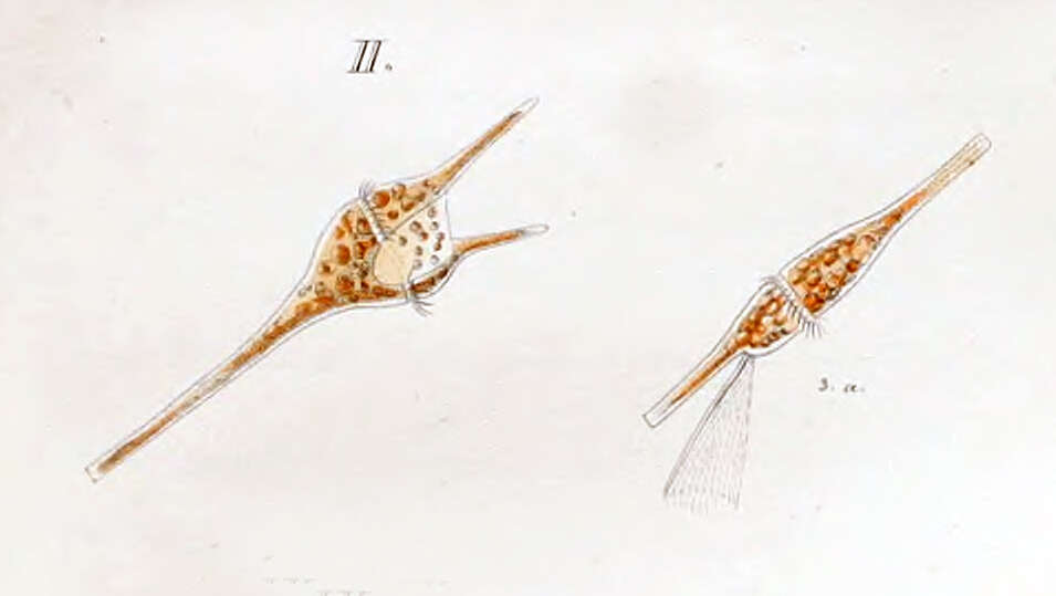
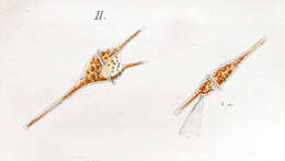
First depiction of the dinoflagellate now know as Ceratium fusus by Christian Ehrenberg in 1834 as Peridinium fusus.
-
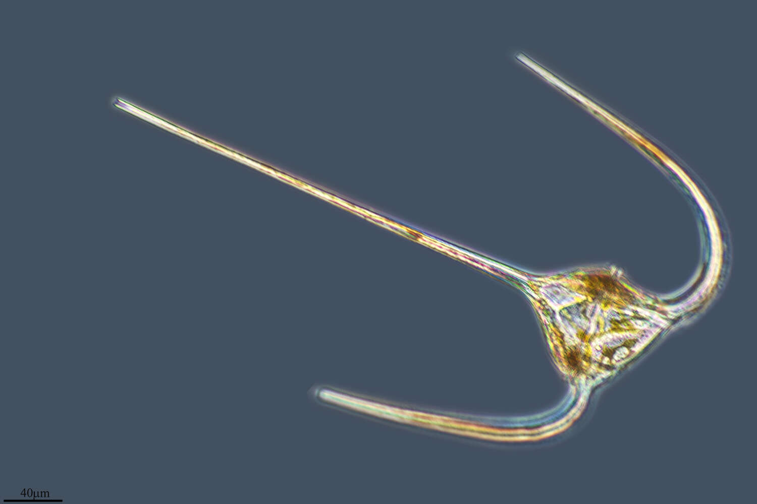
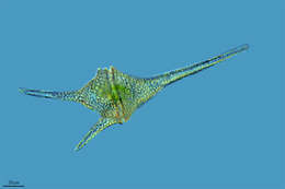
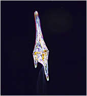
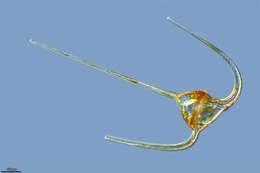
Ceratium furca from the Bay of Villefranche. Living cell, note that the trailing flagella was rotating.
-
-
Illa de Arousa, A, Galicia, Spain
-
First described by Paul Gourret in 1883 as Ceratium fusus, var. extensum. now known as Ceratium extensum or Neoceratium extensum
-
Reboredo, Galicia, Spain
-
Tripos lineatus Scale bar indicates 50 µm. The specimen was gathered in the Kieler Förde (Baltic Sea). Sampling date 2/2022. The image was built up using several photomicrographic frames with manual stacking technique. Images were taken using Zeiss Axioplan with Olympus OM-D M5 MKII. Image under Creative Commons License V 3.0 (CC BY-NC-SA). Place name: Baltic Sea, Kieler Förde, Kiel Fjord (Germany) Latitude: 54,3894126 Longitude: 10,1749055 Multiebenen-Abbildung, manuell gestapelt. Der Messbalken markiert eine Länge von 50 µm. Probe aus der Kieler Förde. Datum der Aufsammlung: 2/2022. Mikrotechnik: Zeiss Axioplan, Kamera: Olympus OM-D M5 MKII. Creative Commons License V 3.0 (CC BY-NC-SA). For permission to use of (high-resolution) images please contact postmaster@protisten.de.
-
Ceratium Cyst Scale bar indicates 25 µm. Collected from a pond near the Bodden bay Schwarzer Peter in the southern part of the isle Hiddensee (German Baltic Sea). Sampling date 10/2018. The image was built up using several photomicrographic frames with manual stacking technique. Images were taken using Zeiss Standard with Olympus OM-D M5 MKII. Image under Creative Commons License V 3.0 (CC BY-NC-SA). Place name: Pond near the Bodden bay Schwarzer Peter, Hiddensee (German Baltic Sea) Latitude: 54,514946 Longitude: 13,082471 Multiebenen-Abbildung, manuell gestapelt. Der Messbalken markiert eine Länge von 25 µm. Probe aus einem Teich nahe der Boddenbucht Schwarzer Peter auf Hiddensee. Datum der Aufsammlung: 10/2018. Mikrotechnik: Zeiss Standard, Kamera: Olympus OM-D M5 MKII. Creative Commons License V 3.0 (CC BY-NC-SA). For permission to use of (high-resolution) images please contact postmaster@protisten.de.
-
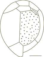
Fig 1: Coolia monotis Schematic diagram (hypothecal view) redrawn from Tomas et al. 1997.
-
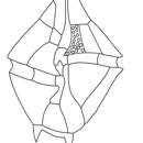
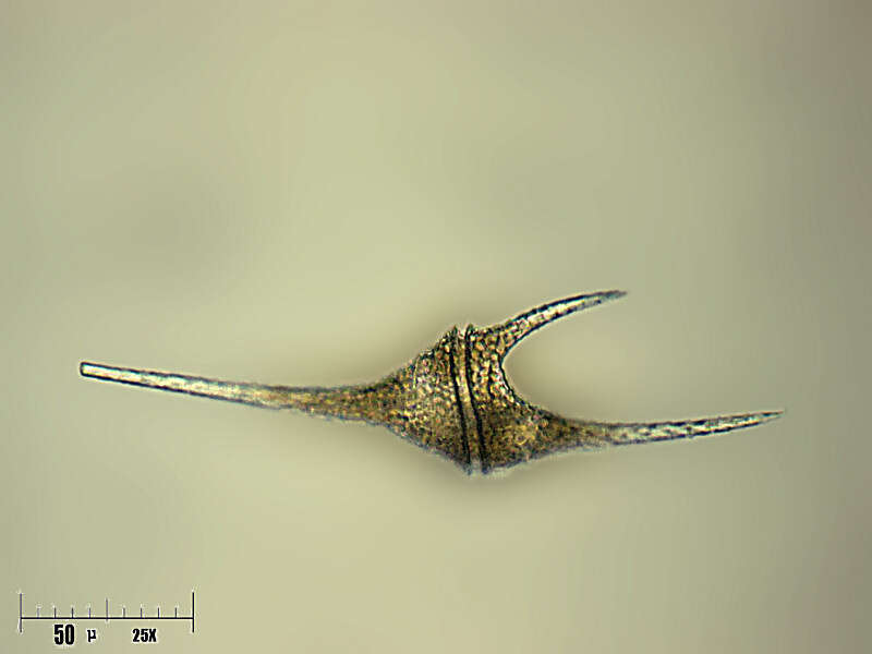
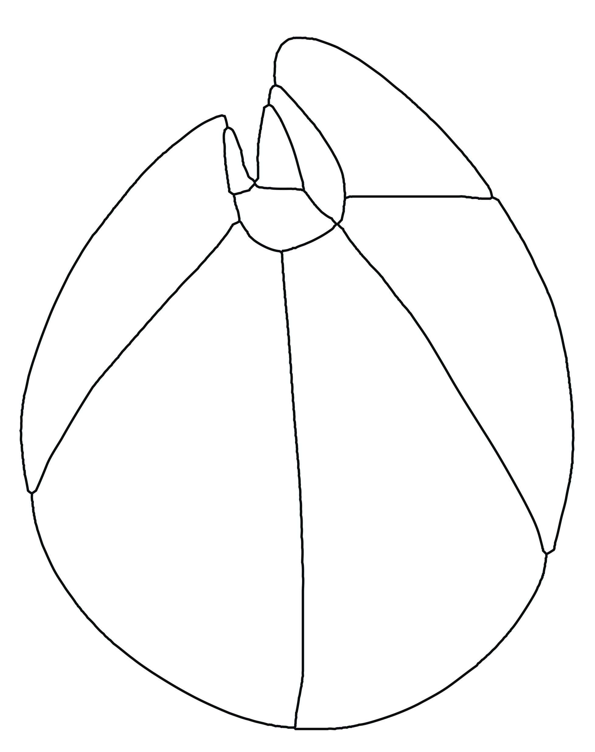
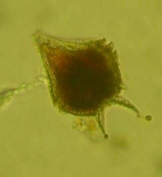
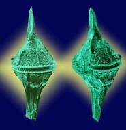
G. spinifera cells are slightly longer than broad. The epictheca has convex sides and a small epical horn. The hypotheca has a 2-4 antapical spines. The sulcus extends almoust the whole length of the cell. The cingulum is deeply excavated and displaced by 2 or more widths. G. spinifera is sometimes confused with Gonyaulax digitale.
-
San Martin De Castaneda, Castille and Leon, Spain
-
From the Bay of Villefranche in December 2013
-
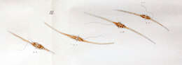
First depiction of Ceratium furca was by Christian Ehrenberg in 1834 as Perdinium furca. Note the drawing of a rotating flagella.
-
Illa de Arousa, A, Galicia, Spain
-
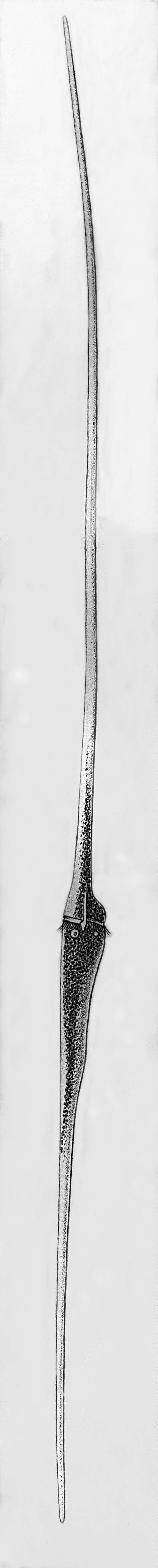
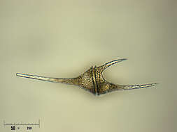
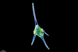
Ceratium extensum (or Neoceratium extensum), the longest Ceratium species. Specimen from the Bay of Villefranche.
-
Reboredo, Galicia, Spain
-
Tripos fusus Aka Ceratium fusus. Scale bar indicates 100 µm. The specimen was gathered in the Kieler Förde (German Baltic Sea). Sampling date 3/2018. The image was built up using several photomicrographic frames with manual stacking technique. Images were taken using Zeiss Axioplan with Olympus OM-D M5 MKII. Image under Creative Commons License V 3.0 (CC BY-NC-SA). Place name: North Sea around Heligoland Latitude: 54,186311 Longitude: 7,895034 Vormals Ceratium fusus. Multiebenen-Abbildung, manuell gestapelt. Der Messbalken markiert eine Länge von 100 µm. Probe aus der Kieler Förde. Datum der Aufsammlung: 3/2018. Mikrotechnik: Zeiss Axioplan, Kamera: Olympus OM-D M5 MKII. Creative Commons License V 3.0 (CC BY-NC-SA). For permission to use of (high-resolution) images please contact postmaster@protisten.de.
-
Tripos muelleri Scale bar indicates 100 µm. The specimen was gathered in the Kieler Förde (Baltic Sea). Sampling date 2/2022. The image was built up using several photomicrographic frames with manual stacking technique. Images were taken using Zeiss Axioplan with Olympus OM-D M5 MKII. Image under Creative Commons License V 3.0 (CC BY-NC-SA). Place name: Baltic Sea, Kieler Förde, Kiel Fjord (Germany) Latitude: 54,3894126 Longitude: 10,1749055 Multiebenen-Abbildung, manuell gestapelt. Der Messbalken markiert eine Länge von 100 µm. Probe aus der Kieler Förde. Datum der Aufsammlung: 3/2022. Mikrotechnik: Olympus stereo microscope SZX16/Planapo 2.0x, Kamera: Olympus OM-D M5 MKII. Creative Commons License V 3.0 (CC BY-NC-SA). For permission to use of (high-resolution) images please contact postmaster@protisten.de.
-
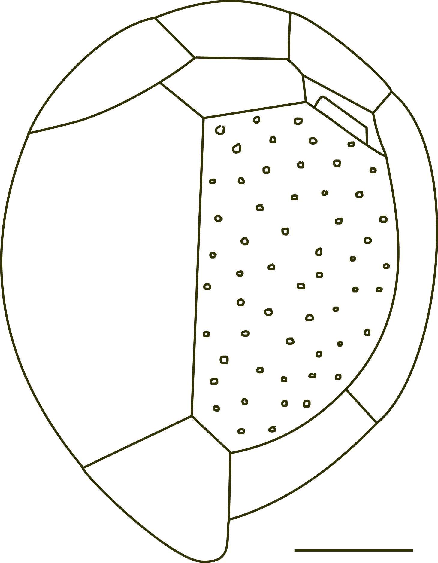
Fig 2: Coolia monotis Schematic diagram (epithecal view) redrawn from Tomas et al. 1997
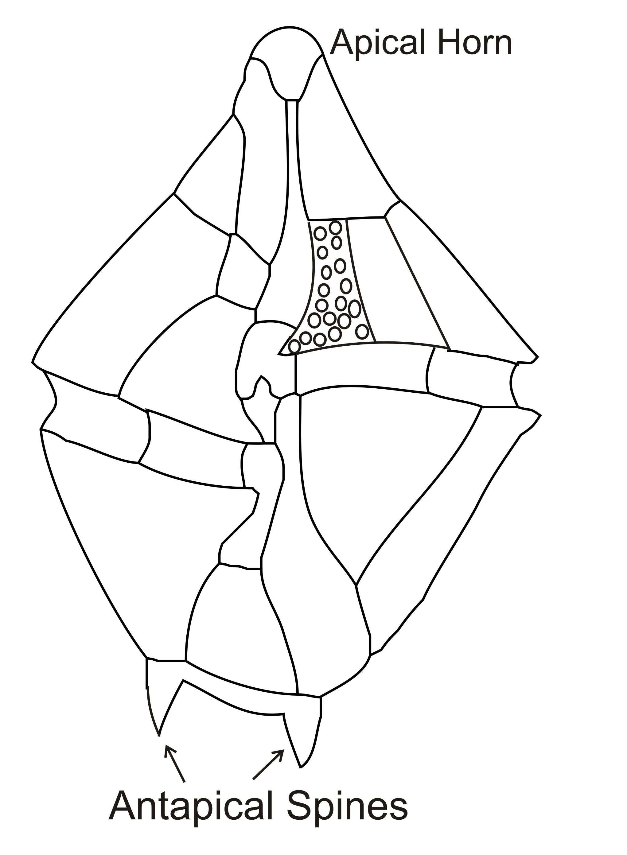
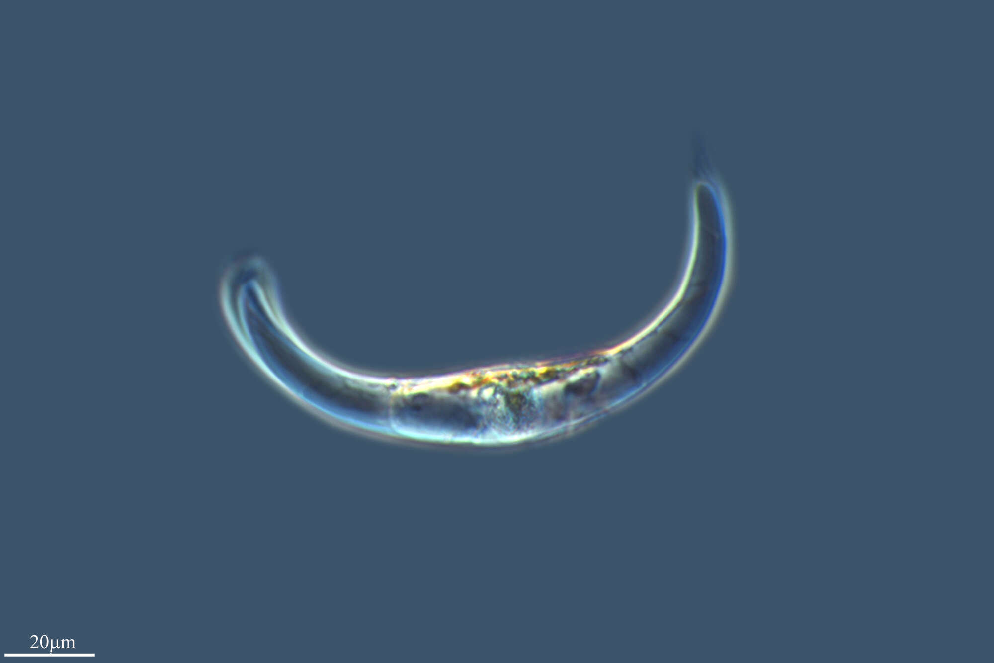