-
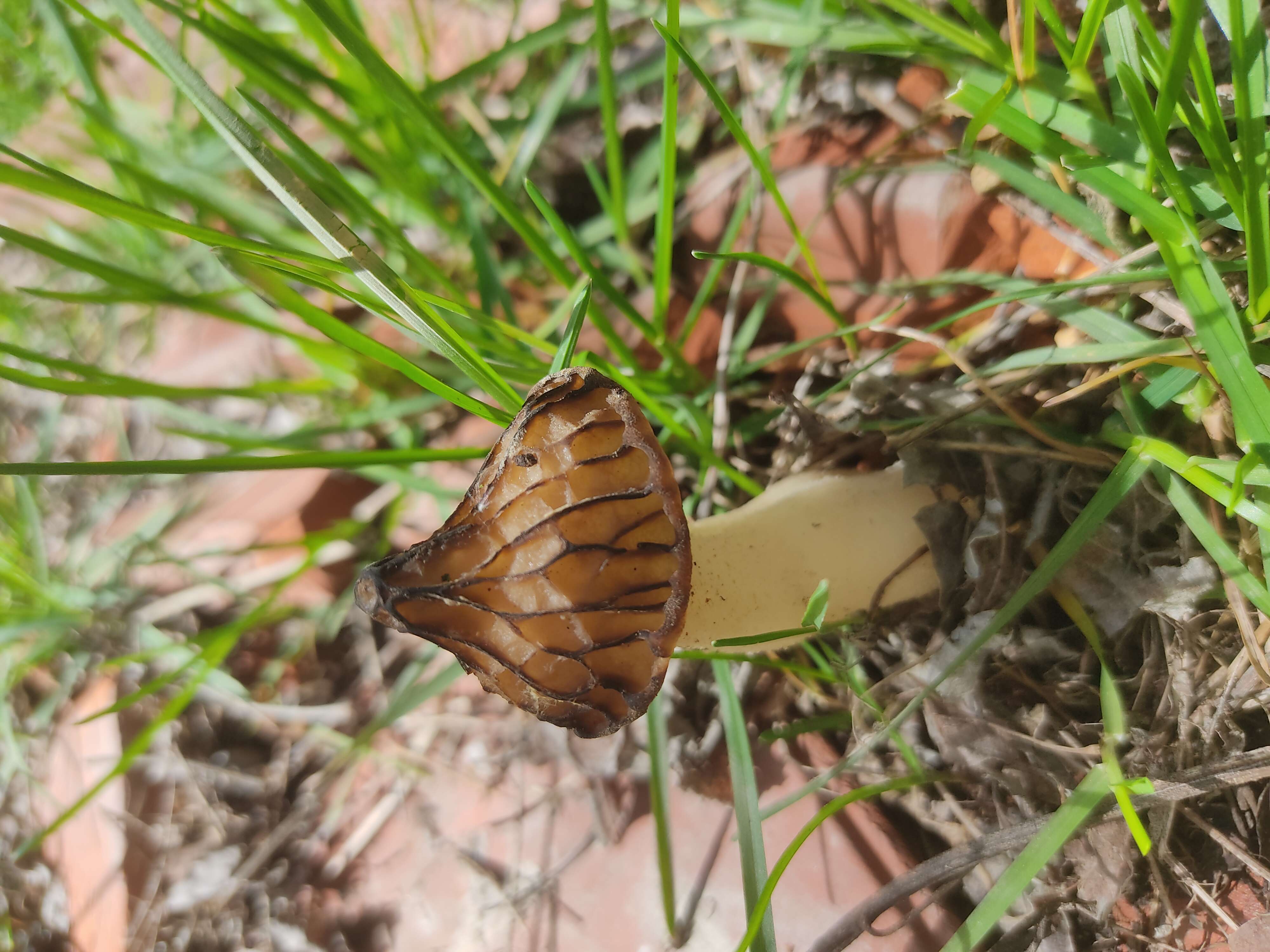
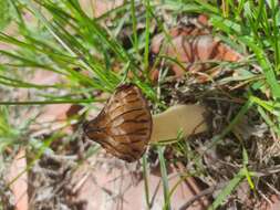
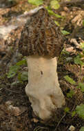
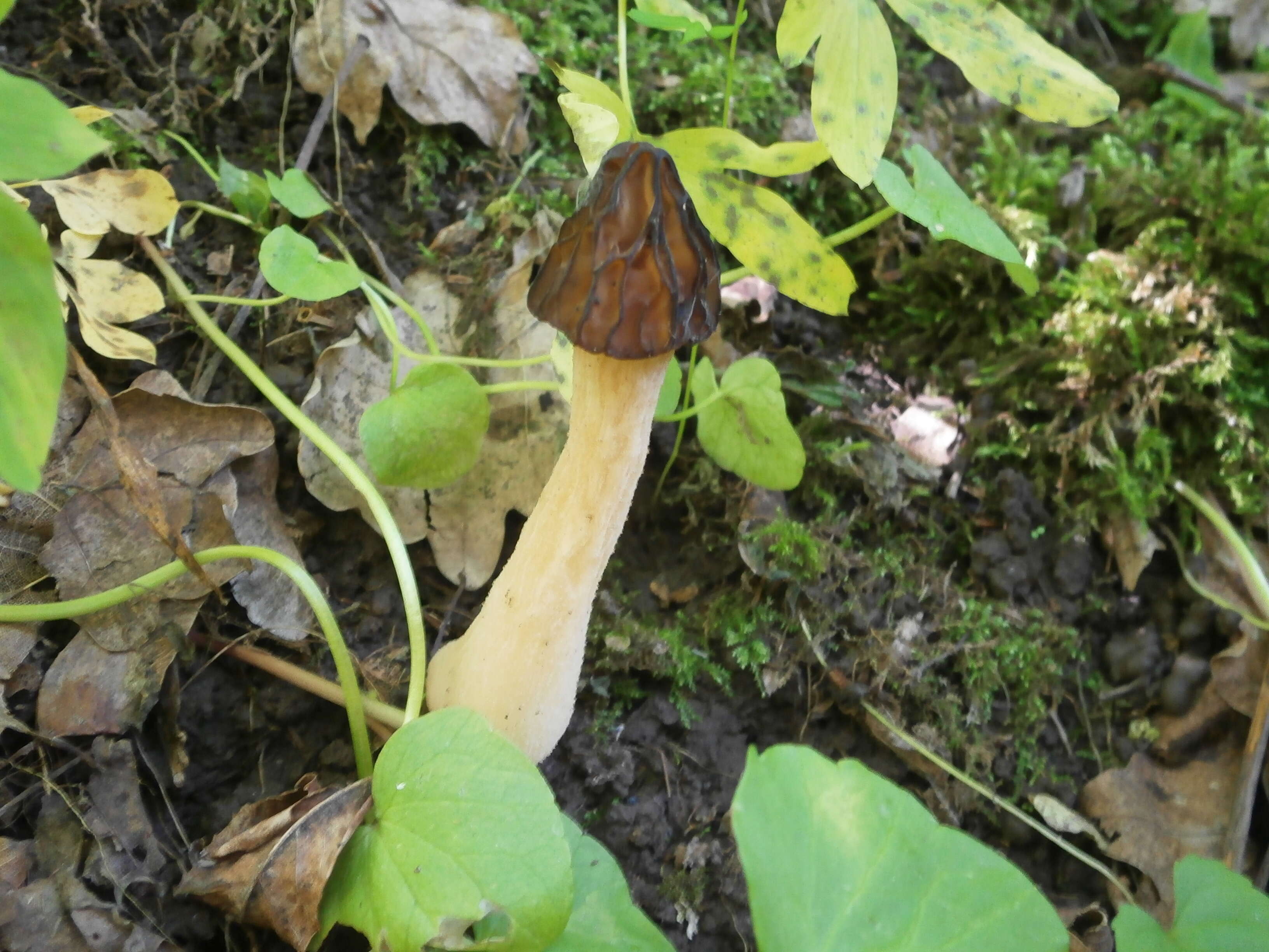
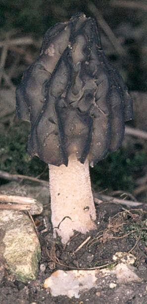
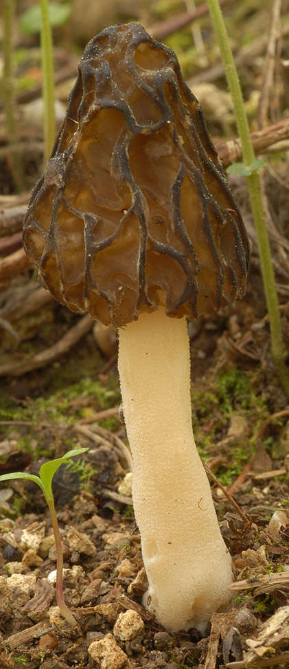
Description: Українська: «
Банний Яр», Сумський р-н: Могрицька с/р; лісовий масив між смт. Кияниця та с. Мокриця. ДП «Сумський лісгосп»: Могрицьке л-во, кв. 26, 42-43, 52 : This is a photo of a natural heritage site in Ukraine, id:
59-247-5009. Date: 11 May 2016, 12:20:31. Source: Own work. Author:
Tusharina. Camera location
51° 03′ 24.84″ N, 35° 00′ 30.54″ E View all coordinates using:
OpenStreetMap 51.056899; 35.008483.
-

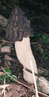
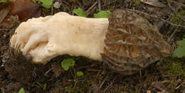
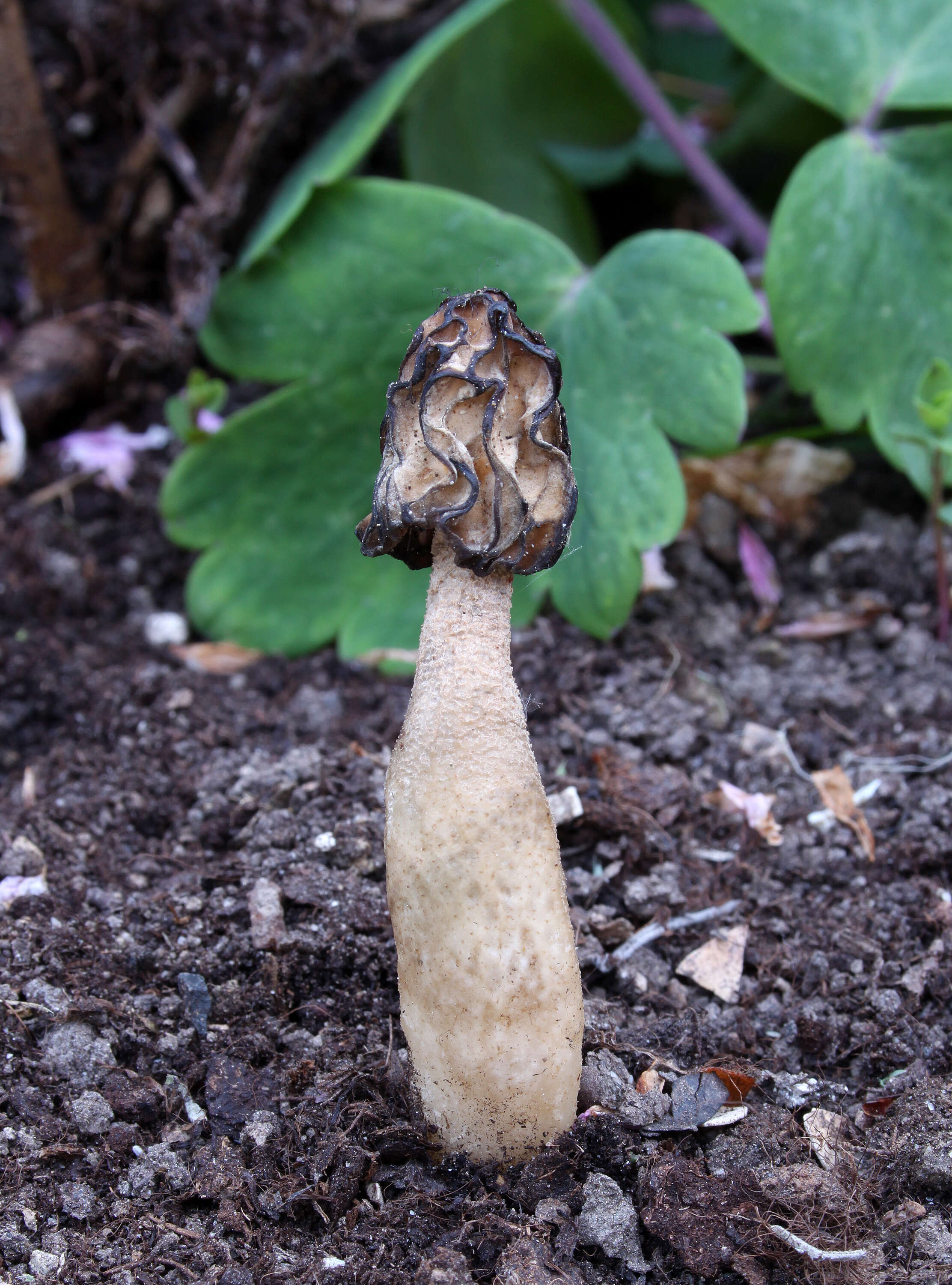
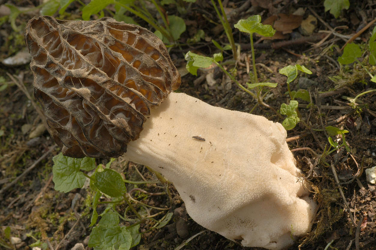
Summary.mw-parser-output table.commons-file-information-table,.mw-parser-output.fileinfotpl-type-information{border:1px solid #a2a9b1;background-color:#f8f9fa;padding:5px;font-size:95%;border-spacing:2px;box-sizing:border-box;margin:0;width:100%}.mw-parser-output table.commons-file-information-table>tbody>tr,.mw-parser-output.fileinfotpl-type-information>tbody>tr{vertical-align:top}.mw-parser-output table.commons-file-information-table>tbody>tr>td,.mw-parser-output table.commons-file-information-table>tbody>tr>th,.mw-parser-output.fileinfotpl-type-information>tbody>tr>td,.mw-parser-output.fileinfotpl-type-information>tbody>tr>th{padding:4px}.mw-parser-output.fileinfo-paramfield{background:#ccf;text-align:right;padding-right:0.4em;width:15%;font-weight:bold}.mw-parser-output.commons-file-information-table+table.commons-file-information-table,.mw-parser-output.commons-file-information-table+div.commons-file-information-table>table{border-top:0;padding-top:0;margin-top:-8px}@media only screen and (max-width:719px){.mw-parser-output table.commons-file-information-table,.mw-parser-output.commons-file-information-table.fileinfotpl-type-information{border-spacing:0;padding:0;word-break:break-word;width:100%!important}.mw-parser-output.commons-file-information-table>tbody,.mw-parser-output.fileinfotpl-type-information>tbody{display:block}.mw-parser-output.commons-file-information-table>tbody>tr>td,.mw-parser-output.commons-file-information-table>tbody>tr>th,.mw-parser-output.fileinfotpl-type-information>tbody>tr>td,.mw-parser-output.fileinfotpl-type-information>tbody>tr>th{padding:0.2em 0.4em;text-align:left;text-align:start}.mw-parser-output.commons-file-information-table>tbody>tr,.mw-parser-output.fileinfotpl-type-information>tbody>tr{display:flex;flex-direction:column}.mw-parser-output.commons-file-information-table+table.commons-file-information-table,.mw-parser-output.commons-file-information-table+div.commons-file-information-table>table{margin-top:-1px}.mw-parser-output.fileinfo-paramfield{box-sizing:border-box;flex:1 0 100%;width:100%}} Description: English: Semifree Morel (Morchella semilibera). Date: 18 April 2023. Source:
https://www.inaturalist.org/photos/268812480. Author:
bjoerns. Camera location
51° 32′ 17.02″ N, 6° 41′ 40.68″ E View all coordinates using:
OpenStreetMap 51.538062; 6.694634.
: This media file is part of an observation on
iNaturalist:
inaturalist.org/observations/155507656This tag does not indicate the copyright status of the attached work. A normal
copyright tag is still required. See
Commons:Licensing. : This image was originally posted to iNaturalist by
bjoerns at
https://www.inaturalist.org/photos/268812480. It was reviewed on 27 April 2023 by
INaturalistReviewBot and found to be published under the terms of the Cc-by-sa-4.0 license. Reason: sha1.
-
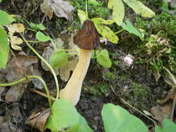
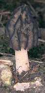
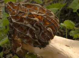
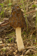
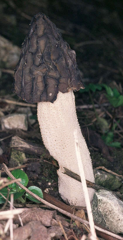
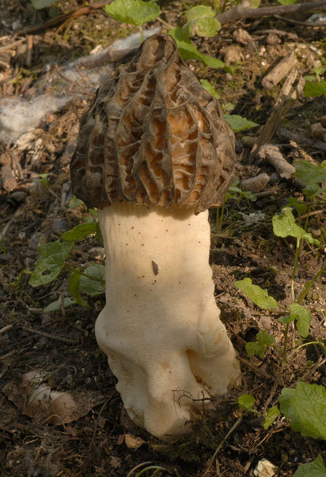
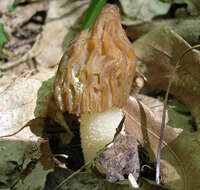
Description: English: Old Half-Free Morel, Morchella gigas syn. Morchella semilibera, Family: Morchellaceae, Location: Germany, Ehingen, Risstissen Deutsch: Alte Kaeppchen Morchel, Glocken Morchel oder Halbfreie Morchel, Morchella gigas Syn. Morchella semilibera, Familie: Morchellaceae, Fundort: Deutschland, Ehingen, Risstissen. Date: 9 May 2012. Source: Own work. Author:
Holger Krisp. Object location
48° 15′ 57.39″ N, 9° 49′ 30.24″ E View all coordinates using:
OpenStreetMap 48.265942; 9.825067.
-
-

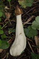
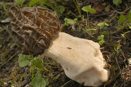
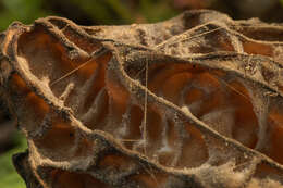
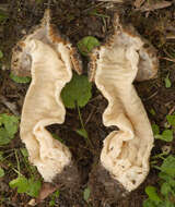
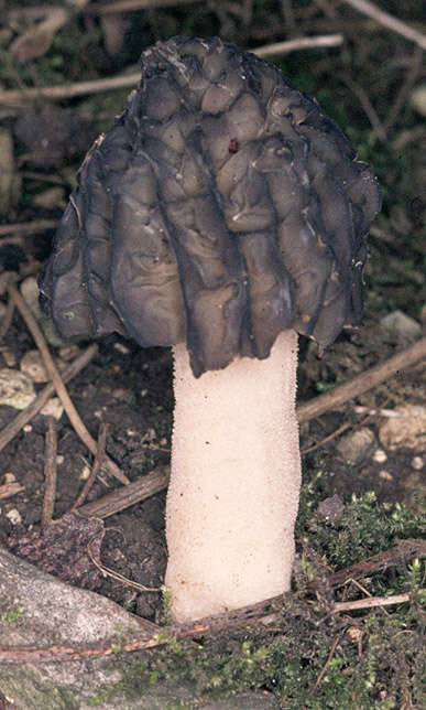
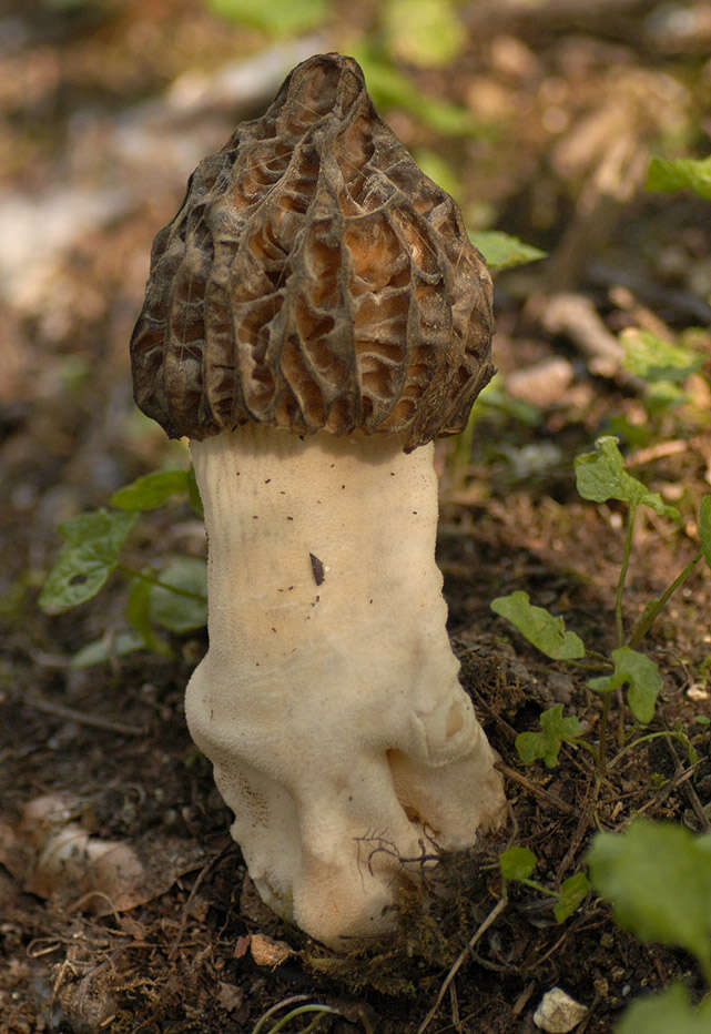
Summary.mw-parser-output table.commons-file-information-table,.mw-parser-output.fileinfotpl-type-information{border:1px solid #a2a9b1;background-color:#f8f9fa;padding:5px;font-size:95%;border-spacing:2px;box-sizing:border-box;margin:0;width:100%}.mw-parser-output table.commons-file-information-table>tbody>tr,.mw-parser-output.fileinfotpl-type-information>tbody>tr{vertical-align:top}.mw-parser-output table.commons-file-information-table>tbody>tr>td,.mw-parser-output table.commons-file-information-table>tbody>tr>th,.mw-parser-output.fileinfotpl-type-information>tbody>tr>td,.mw-parser-output.fileinfotpl-type-information>tbody>tr>th{padding:4px}.mw-parser-output.fileinfo-paramfield{background:#ccf;text-align:right;padding-right:0.4em;width:15%;font-weight:bold}.mw-parser-output.commons-file-information-table+table.commons-file-information-table,.mw-parser-output.commons-file-information-table+div.commons-file-information-table>table{border-top:0;padding-top:0;margin-top:-8px}@media only screen and (max-width:719px){.mw-parser-output table.commons-file-information-table,.mw-parser-output.commons-file-information-table.fileinfotpl-type-information{border-spacing:0;padding:0;word-break:break-word;width:100%!important}.mw-parser-output.commons-file-information-table>tbody,.mw-parser-output.fileinfotpl-type-information>tbody{display:block}.mw-parser-output.commons-file-information-table>tbody>tr>td,.mw-parser-output.commons-file-information-table>tbody>tr>th,.mw-parser-output.fileinfotpl-type-information>tbody>tr>td,.mw-parser-output.fileinfotpl-type-information>tbody>tr>th{padding:0.2em 0.4em;text-align:left;text-align:start}.mw-parser-output.commons-file-information-table>tbody>tr,.mw-parser-output.fileinfotpl-type-information>tbody>tr{display:flex;flex-direction:column}.mw-parser-output.commons-file-information-table+table.commons-file-information-table,.mw-parser-output.commons-file-information-table+div.commons-file-information-table>table{margin-top:-1px}.mw-parser-output.fileinfo-paramfield{box-sizing:border-box;flex:1 0 100%;width:100%}} Description: English: Semifree Morel (Morchella semilibera). Date: 15 April 2023. Source:
https://www.inaturalist.org/photos/267907274. Author:
bjoerns. Camera location
51° 12′ 02.75″ N, 6° 52′ 13.25″ E View all coordinates using:
OpenStreetMap 51.200764; 6.870348.
: This media file is part of an observation on
iNaturalist:
inaturalist.org/observations/155017943This tag does not indicate the copyright status of the attached work. A normal
copyright tag is still required. See
Commons:Licensing. : This image was originally posted to iNaturalist by
bjoerns at
https://www.inaturalist.org/photos/267907274. It was reviewed on 27 April 2023 by
INaturalistReviewBot and found to be published under the terms of the Cc-by-sa-4.0 license. Reason: sha1.
-
Summary.mw-parser-output table.commons-file-information-table,.mw-parser-output.fileinfotpl-type-information{border:1px solid #a2a9b1;background-color:#f8f9fa;padding:5px;font-size:95%;border-spacing:2px;box-sizing:border-box;margin:0;width:100%}.mw-parser-output table.commons-file-information-table>tbody>tr,.mw-parser-output.fileinfotpl-type-information>tbody>tr{vertical-align:top}.mw-parser-output table.commons-file-information-table>tbody>tr>td,.mw-parser-output table.commons-file-information-table>tbody>tr>th,.mw-parser-output.fileinfotpl-type-information>tbody>tr>td,.mw-parser-output.fileinfotpl-type-information>tbody>tr>th{padding:4px}.mw-parser-output.fileinfo-paramfield{background:#ccf;text-align:right;padding-right:0.4em;width:15%;font-weight:bold}.mw-parser-output.commons-file-information-table+table.commons-file-information-table,.mw-parser-output.commons-file-information-table+div.commons-file-information-table>table{border-top:0;padding-top:0;margin-top:-8px}@media only screen and (max-width:719px){.mw-parser-output table.commons-file-information-table,.mw-parser-output.commons-file-information-table.fileinfotpl-type-information{border-spacing:0;padding:0;word-break:break-word;width:100%!important}.mw-parser-output.commons-file-information-table>tbody,.mw-parser-output.fileinfotpl-type-information>tbody{display:block}.mw-parser-output.commons-file-information-table>tbody>tr>td,.mw-parser-output.commons-file-information-table>tbody>tr>th,.mw-parser-output.fileinfotpl-type-information>tbody>tr>td,.mw-parser-output.fileinfotpl-type-information>tbody>tr>th{padding:0.2em 0.4em;text-align:left;text-align:start}.mw-parser-output.commons-file-information-table>tbody>tr,.mw-parser-output.fileinfotpl-type-information>tbody>tr{display:flex;flex-direction:column}.mw-parser-output.commons-file-information-table+table.commons-file-information-table,.mw-parser-output.commons-file-information-table+div.commons-file-information-table>table{margin-top:-1px}.mw-parser-output.fileinfo-paramfield{box-sizing:border-box;flex:1 0 100%;width:100%}} Description: Српски / srpski: Zvonasti smrčak (Morchella semilibera) je vrsta jestive gljive iz porodice smrčaka (Morchellaceae). U narodu je poznata i pod nazivom hibridni smrčak. Plodonosi u aprilu po parkovima, u grmlju, uz rubove šuma i po dvorištima. Date: 22 April 2022, 11:41:50. Source: Own work. Author:
Bojanicka.
-
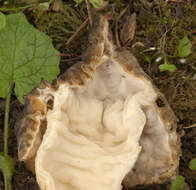
Longitude (deg): -0.7. Latitude (deg): 53.9. Longitude (deg/min): 0° 50' W. Latitude (deg/min): 53° 60' N. Vice county name: South-east Yorks. Vice county no.: 61. Country: England. Stage: Fruitbody. Identified by: Malcolm Storey. Category: standard photograph or close-up. Photographic equipment used: "35mm transparencies (on a variety of films, but Agfa CT18 in the 1960's to early 1980's followed by Fujichrome in the late 1980's.) Transparencies scanned with Minolta Dimage Scan Dual II AF-2820U transparency scanner.".
-
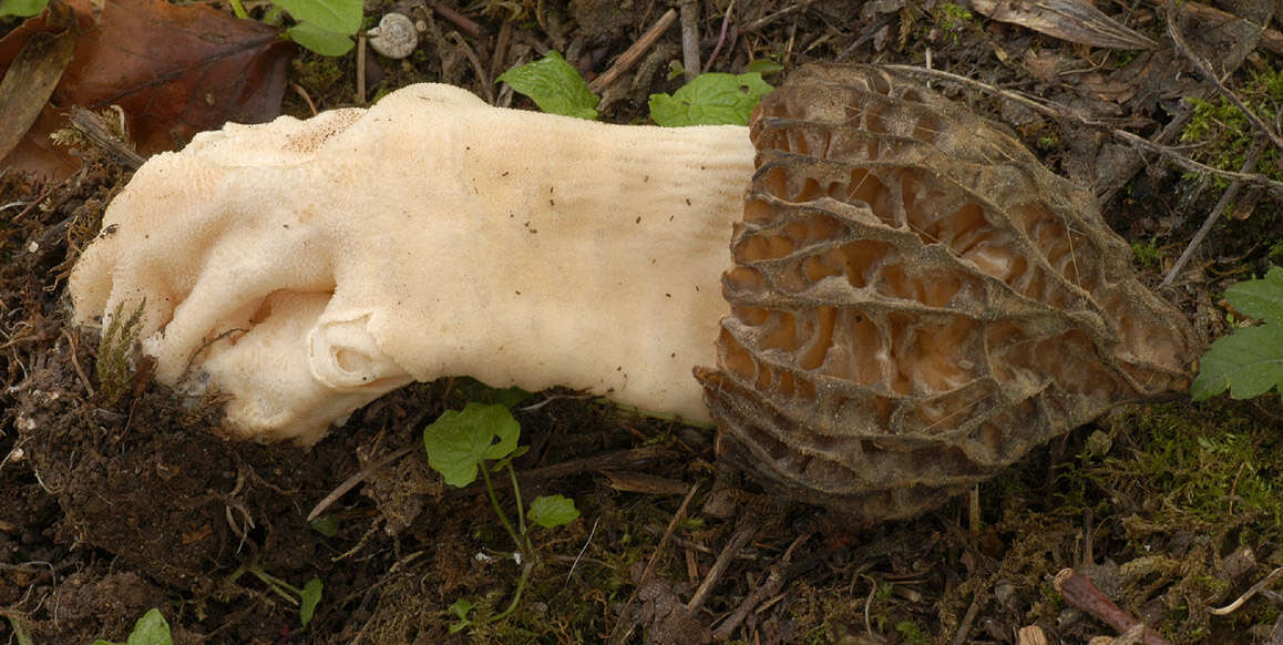
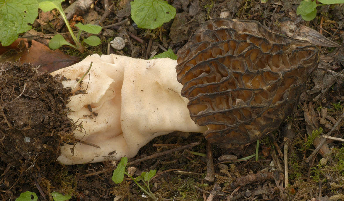
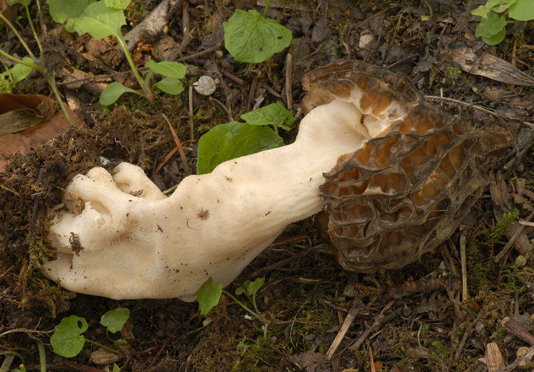
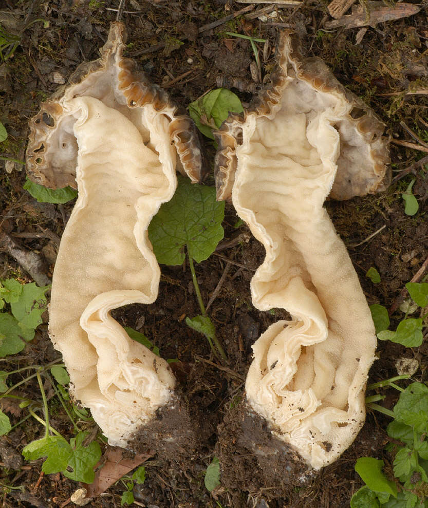
Longitude (deg): -0.8. Latitude (deg): 51.1. Longitude (deg/min): 0° 50' W. Latitude (deg/min): 51° 10' N. Vice county name: Bucks. Vice county no.: 24. Country: England. Stage: Fruitbody. Identified by: Malcolm Storey. Comment: "large specimen growing out of roadside bank, under elder, elm, cherry, ash.". Category: standard photograph or close-up. Photographic equipment used: Nikon D100 dSLR with Tamron SP T90 AF Macro 1:1 lens.
-
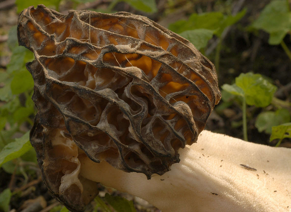
Longitude (deg): -0.8. Latitude (deg): 51.1. Longitude (deg/min): 0° 50' W. Latitude (deg/min): 51° 10' N. Vice county name: Bucks. Vice county no.: 24. Country: England. Stage: Fruitbody. Identified by: Malcolm Storey. Comment: "large specimen growing out of roadside bank, under elder, elm, cherry, ash.". Category: macro-photograph. Image scaling: enlarged. Photographic equipment used: Nikon D100 dSLR with Tamron SP T90 AF Macro 1:1 lens.
-
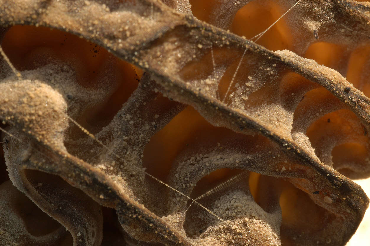
Longitude (deg): -0.8. Latitude (deg): 51.1. Longitude (deg/min): 0° 50' W. Latitude (deg/min): 51° 10' N. Vice county name: Bucks. Vice county no.: 24. Country: England. Stage: Fruitbody. Identified by: Malcolm Storey. Comment: "large specimen growing out of roadside bank, under elder, elm, cherry, ash.". Category: microscope photograph. Image scaling: magnified. Photographic equipment used: Nikon D100 dSLR with Tamron SP T90 AF Macro 1:1 lens.
-
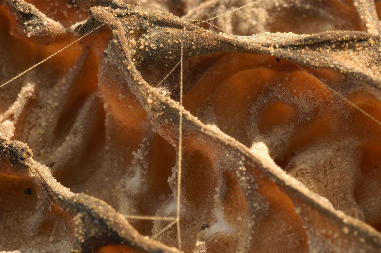
Longitude (deg): -0.8. Latitude (deg): 51.1. Longitude (deg/min): 0° 50' W. Latitude (deg/min): 51° 10' N. Vice county name: Bucks. Vice county no.: 24. Country: England. Stage: Fruitbody. Identified by: Malcolm Storey. Comment: "large specimen growing out of roadside bank, under elder, elm, cherry, ash.". Category: microscope photograph. Image scaling: magnified. Photographic equipment used: Nikon D100 dSLR with Tamron SP T90 AF Macro 1:1 lens.
-
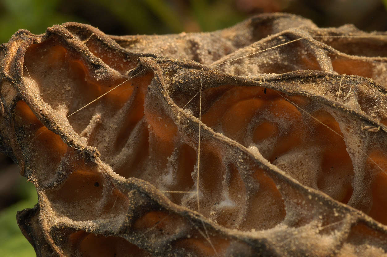
Longitude (deg): -0.8. Latitude (deg): 51.1. Longitude (deg/min): 0° 50' W. Latitude (deg/min): 51° 10' N. Vice county name: Bucks. Vice county no.: 24. Country: England. Stage: Fruitbody. Identified by: Malcolm Storey. Comment: "large specimen growing out of roadside bank, under elder, elm, cherry, ash.". Category: microscope photograph. Image scaling: magnified. Photographic equipment used: Nikon D100 dSLR with Tamron SP T90 AF Macro 1:1 lens.
-
Longitude (deg): -0.8. Latitude (deg): 51.1. Longitude (deg/min): 0° 50' W. Latitude (deg/min): 51° 10' N. Vice county name: Bucks. Vice county no.: 24. Country: England. Stage: Fruitbody. Identified by: Malcolm Storey. Comment: "large specimen growing out of roadside bank, under elder, elm, cherry, ash.". Category: standard photograph or close-up. Photographic equipment used: Nikon D100 dSLR with Tamron SP T90 AF Macro 1:1 lens.
-
Longitude (deg): -0.8. Latitude (deg): 51.1. Longitude (deg/min): 0° 50' W. Latitude (deg/min): 51° 10' N. Vice county name: Bucks. Vice county no.: 24. Country: England. Stage: Fruitbody. Identified by: Malcolm Storey. Comment: "7 scattered fruitbodies on disturbed soil, under elder, elm, cherry, ash.". Category: standard photograph or close-up. Photographic equipment used: Nikon D100 dSLR with Tamron SP T90 AF Macro 1:1 lens.


