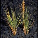
Distichlis spicata is broadly ditributed in North, Central and South America. This terrestrial grass thrives in many coastal environments, as well as inland salt flats and other saline soil substrate.
Also known as Seashore saltgrass or Inland saltgrass, this rhizomous perennial exhibits erect stems rising to a height of up to 50 centimeters. The stiff leaf blades are typically two to ten centimeters long and one to four millimeters wide. Inflorescence panicle-like, 2–8 cm,
# of living roots and rhizomes
(x±s)
at 4 soil depths
This description provides characteristics that may be relevant to fire ecology, and is not meant for identification. Keys for identification are available [35,60,70,80,89,90,93,130,131,133,137,148,156,176,186,190,211,226,231,255,330,338,347,348].
Saltgrass is a warm-season, sod-forming, low-growing, native perennial [6,21,22,64,70,133,170,176,185,231]. At maturity, saltgrass grows to a height of 6 to 18 inches (15-45 cm) [161,175,251,318], but generally does not grow taller than 12 inches (30 cm) [206], particularly when in dense colonies [131]. In pure stands, saltgrass is extremely dense. Tolstead [312] observed 2,616 saltgrass stems/3 foot² along the shore of Clear Lake in the Nebraska sandhills. When found in "hypersaline" areas, saltgrass may grow in a dwarfed form [98,260,321]. Saltgrass grows in a dwarfed form on soil with salinity levels as high as 8.1% around Stink and Bitter lakes, South Dakota [321,322].
Saltgrass's aerial culms are decumbent to erect, solid, and wiry [52,137,156,231]. Leaves are distributed fairly equally up the entire length of the culms [133]. The leaf blades are spreading, crowded, flat, sharp-pointed, usually 0.8 to 4.7 inches (2-12 cm) long and 1 to 3.5 mm wide [190,305,318]. Saltgrass is strongly rhizomatous [70,133,152]. Rhizomes are scaly and reach average depths of 4 to 10 inches (10-30 cm) in the soil [144,161,181,206,275]. Rhizome growth is monopodial [41]. Rhizomes and roots of saltgrass create dense mats [65,103]. Saltgrass rhizomes have sharp points with numerous epidermal silica cells that aid in penetration of heavy soils [144]. At Goshen, Utah, rhizomes reached a length of 71 inches (180 cm) [144].
Saltgrass is dioecious. The pistillate panicles, which are often congested, are 0.4 to 3 inches (1-7 cm) long and produce 2 to 20 spikelets [35,89,137,148,175,186,228,305,318]. The spikelets are unisexual, 8 to 22 mm long, and 5- to 18-flowered [35,70,89,137,148,186,228,305,318]. Fruits are awnless caryopses, 2 to 5 mm long [7,61,70,175]. The male inflorescence of saltgrass is larger, more dense, and on longer culms than the inflorescence of female plants [242].
The root system of saltgrass is adventitious. Roots of saltgrass have tissue with an empty cavity which is continuous with the empty cavity tissue in the rhizomes and leaf sheath providing an aerenchymatous network that allows for gas exchange under very wet soil conditions, during brief periods of partial submersion in water, in anoxic environments, and/or growth in heavy clay soils [71,144]. Saltgrass roots grow to depths of 28 inches (70 cm) on natural sand dunes created by artesian wells emerging from playas at Owens Lake, California. The greatest concentration of roots is in the 4- to 16-inch (10-40 cm) zone. Some of the saltgrass roots and rhizomes with an oxidized rhizosphere were found to penetrate approximately 4 inches (10 cm) into an anoxic soil zone [71]. In a tidal salt marsh in Connecticut, saltgrass roots reached a maximum of 16.7 inches (42.5 cm) in the sandy soils [65]. Soil samples were taken at the Price Lake Area of the Rockefeller Refuge, Louisiana, to determine the depth to which the roots and rhizomes of saltgrass reach in the soil. The percent of a saltgrass plant's roots and rhizomes at various depths in the soil are presented below [217]:
Depth in inches Roots (%) Rhizomes (%) 0-1 27.03 25.36 1-2 28.13 35.69 2-3 18.68 24.43 3-4 9.24 9.13 4-5 5.76 5.09 5-6 3.36 0.01 6-7 2.49 0.0 7-8 2.22 0.0 8-9 1.82 0.0 9-10 1.27 0.0Saltgrass roots in Connecticut are colonized by vesicular arbuscular mycorrhizae (VAM) fungi from 1 inch (2.5 cm) to 16.7 inches (42.5 cm) below the soil surface [65]. Several authors discuss the effects of VAM on the growth of saltgrass [63,65,66,158,182].
As a clonal plant, saltgrass can share resources among ramets in patchy environments. This allows saltgrass to expand into habitats more suitable for growth, and support ramets experiencing physical stress. Numerous studies have evaluated the importance of saltgrass clonal growth to survive physical stress in hypersaline environments along the Atlantic coast [29,30,41,246,283] and the deserts of the southwestern United States [6,144].
Saltgrass plants commonly grow in female- or male-majority populations, a pattern known as spatial segregation of the sexes [112]. Eppley [101] studied saltgrass populations in 3 salt marshes in central California at Tomales Bay, Point Reyes National Seashore, and Bodega Bay Marine Laboratory. She found that habitats with female majorities are located at significantly (p<0.05) lower elevations in the marshes than are habitats with male majorities. Eppley also concluded that soil salinity levels were not significantly (p<0.05) different between male- (8.75 mS/cm) and female- (8.72 mS/cm) majority populations [101].
Eppley and others [103] further concluded that flowering saltgrass ramets are significantly (p<0.0001) more likely to have neighbors of the same sex than of the opposite sex. They provide 3 explanations for spatial segregation of the sexes in saltgrass: 1) Since saltgrass propagates by rhizomes, patches exhibiting gender bias may be caused by local asexual proliferation by one or a few genets. 2) Spatial segregation of flowering ramets could be caused by different clonal growth rates by males and females in different habitats. 3) Differential flowering rates by male and female plants in different microhabitats causes spatial segregation [103].
Saltgrass has a 2-celled salt gland found on both the adaxial and abaxial leaf surfaces either in the furrows or along the sides of the ridges that allows for the extrusion of salt. Salt is excreted by pressure through the cuticle, which covers the cap cell of the salt gland [144,151,329,346].
Several authors note that the rate of photosynthesis in saltgrass plants increases with increased light intensity and decreases with heightened soil salinity levels [178,262,309,329]. Hence, with lower photosynthesis rates, saltgrass plants growing in increasingly higher saline environments exhibit a reduction in net productivity and growth [329].
Fire adaptations: Saltgrass establishes after fire through seed and/or lateral spread by rhizomes [77,121,194,287,290,293].
FIRE REGIMES: Plant communities providing saltgrass habitat are diverse and exhibit a wide range of fire frequencies. Saltgrass is found in southeastern and Gulf Coast marshes where fires may occur once or more every year [122,328] and in desert shrub communities that have fire return intervals of less than 35 to over 100 years [165,244]. Saltgrass is a cover species in the northern cordgrass prairie. Without intervention by Native Americans, marsh islands in this community may have been completely fire free [188].
Desert grassland communities: Prior to land use changes, grassland communities where saltgrass occurs burned regularly [218,344]. While there is relatively little fire frequency information available on the time prior to the 1880s, it is estimated that fire occurred every 7 to 10 years [218]. In some areas grassland fires played an important role in thwarting invasion by woody vegetation such as mesquite (Prosopis spp.), creosote, and juniper (Juniperus spp.) [263]. However, grazing pressures and fire exclusion have promoted the conversion of desert grassland communities to shrub-dominated communities [244]. The establishment of shrubs in desert grasslands has decreased available fuels and, subsequently, fire frequencies [47,244,324].
Desert shrub communities: Saltgrass is a dominant species in Afton Canyon, located in the lower Mojave River drainage of the western Mojave Desert, California [203]. Historically, the fire interval in this mesquite-saltbush (Atriplex confertifolia) dominated environment was less than 35 to over 100 years [218,244]. However, the infestation of the drought-deciduous saltcedar (Tamarix ramosissima) has altered the historic fire regime, promoting a fire interval of about 10 to 20 years [203].
Great Basin sagebrush steppe: Saltgrass is found on big basin sagebrush steppes in the intermountain West. The historic fire return interval ranged from 40 to 100 years, but changes in land use and management practices, such as the invasion of cheatgrass (Bromus tectorum), have altered fire return interval to less than every 10 years in some areas [236,244].
Great Plains grasslands: Saltgrass is a minor species in the dry valley and wet meadow habitats (~2% and 1.5% species composition, respectively), an important species (~7%) in the dry meadow habitat, and a dominant species (~46%) in the saltgrass habitats of the tallgrass prairies of the Nebraska sandhills [115]. There is little documentation of the frequency of fire in presettlement times in the sandhills, but fires were likely common, occurring every 1 to 10 years [244,285]. Since the 1900s, lightning-caused fires are well reported and occur often, yet are quickly suppressed [37]. Fire played a beneficial role in preserving the tallgrass prairies of the Nebraska sandhills. Cultivation and suppression of fire on tallgrass prairies has led to an increase in woody vegetation [20,46].
Fire also played an important historical role in Great Plains mixed-grass prairies, where saltgrass occurs. The large tracts of continuous mixed-grass prairie, which occur in seasonally hot, dry areas and accumulate much fine fuel, are susceptible to frequent lightning fires. Early records kept by explorers, trappers, and settlers note a high occurrence of fires, both natural and anthropogenic, with frequent low-severity fires occurring at intervals of 5 to 10 years [81,244,345]. Since the early 1900s, fire has been excluded and nonnative species such as Japanese brome (Bromus japonicus), smooth brome, Kentucky bluegrass, crested wheatgrass (Agropyron cristatum), and Canada thistle (Cirsium arvense) have taken a strong hold in the area [81].
Northern cordgrass prairies: In all of the communities discussed above saltgrass occurs in alkaline wetlands, which have different fuel loads than the surrounding vegetation. Saltgrass-cordgrass communities dominate the northern cordgrass prairies composed of tidal and salt marshes. Very little is known about fire intervals in the northern cordgrass prairies, particularly north of Chesapeake Bay. Frost [116,117] identifies a fire frequency of 1 to 12 years in saline and brackish marshes. In Landfire's Rapid Assessment Reference Condition model of the northern cordgrass prairie, mean occurrence of stand-replacement fires is 7 years, with a range of 2 to 50 years. Stand-replacement fires account for 97% of fires in the northern cordgrass prairie. The other 3% are mixed-severity fires, which occur very infrequently. FIRE REGIMES in the northern cordgrass prairies vary widely because the probability of ignition is affected by the presence of open water channels, connection to uplands, and the natural fire regime of adjacent uplands. Northern cordgrass prairie marsh islands likely would have been fire free unless ignited by Native Americans [188].
Southeastern and Gulf Coast marshes: Fire has always been an important part of southeastern United States coastal marsh ecosystems, where saltgrass is often dominant. Spontaneous combustion has been observed in dry peat soils, and lightning frequently starts marsh fires in Florida and Louisiana [235]. Saltgrass, black rush, sawgrass, and cordgrass are common in estuarine marshes of Everglades National Park, Florida. Except for fires occurring in mangrove (Rhizophora, Avicennia, and/or Laguncularia spp.) communities, where fires were allowed to burn due to inaccessibility and natural containment by mangroves and high water levels, suppression of all fires was National Park Service policy beginning in 1947. Two fire seasons occur in the Everglades: 1) human-caused fires during the dry season November through May, and 2) lightning fires caused by convective storms during the summer. Beginning in 1969 the National Park Service began conducting annual prescribed burning in pinelands, prairies, and marshes at Rockefeller State Wildlife Refuge, Louisiana, where saltgrass codominates with saltmeadow cordgrass and smooth cordgrass. Federal agencies now have an extensive burning program in saltgrass habitats. In Louisiana and Texas, Gabrey and Afton [122,328] observed between 0 to 8 lightning-ignited fires occurring each year from June to August during the years 1993 to 1998. Acreage burned ranged from less than 2 acres (<1 ha) to over 1,240 acres (>500 ha) [122].
The following table provides fire return intervals for plant communities and ecosystems where saltgrass is important. Find further fire regime information for the plant communities in which this species may occur by entering the species name in the FEIS home page under "Find FIRE REGIMES".
Community or Ecosystem Dominant Species Fire Return Interval Range (years) bluestem prairie Andropogon gerardii var. gerardii-Schizachyrium scoparium 183,244] Nebraska sandhills prairie Andropogon gerardii var. paucipilus-Schizachyrium scoparium <10 sagebrush steppe Artemisia tridentata/Pseudoroegneria spicata 20-70 [244] basin big sagebrush Artemisia tridentata var. tridentata 12-43 [271] mountain big sagebrush Artemisia tridentata var. vaseyana 15-40 [11,48,223] Wyoming big sagebrush Artemisia tridentata var. wyomingensis 10-70 (40**) [325,350] saltbush-greasewood Atriplex confertifolia-Sarcobatus vermiculatus 244] mangrove Avicennia nitida-Rhizophora mangle 35-200 [233] desert grasslands Bouteloua eriopoda and/or Pleuraphis mutica <35 to <100 [244] plains grasslands Bouteloua spp. 244,345] blue grama-needle-and-thread grass-western wheatgrass Bouteloua gracilis-Hesperostipa comata-Pascopyrum smithii 244,269,345] blue grama-buffalo grass Bouteloua gracilis-Buchloe dactyloides 244,345] grama-galleta steppe Bouteloua gracilis-Pleuraphis jamesii <35 to <100 blue grama-tobosa prairie Bouteloua gracilis-Pleuraphis mutica 244] cheatgrass Bromus tectorum 249,335] paloverde-cactus shrub Parkinsonia spp./Opuntia spp. <35 to <100 Arizona cypress Cupressus arizonica <35 to 200 northern cordgrass prairie Distichlis spicata-Spartina spp. 1-3 [244] California steppe Festuca-Danthonia spp. 244,304] juniper-oak savanna Juniperus ashei-Quercus virginiana <35 western juniper Juniperus occidentalis 20-70 Rocky Mountain juniper Juniperus scopulorum <35 creosotebush Larrea tridentata <35 to <100 Ceniza shrub Larrea tridentata-Leucophyllum frutescens-Prosopis glandulosa <35 [244] Everglades Mariscus jamaicensis <10 [233] wheatgrass plains grasslands Pascopyrum smithii <5-47+ [244,254,345] pinyon-juniper Pinus-Juniperus spp. <35 [244] Colorado pinyon Pinus edulis 10-400+ [109,134,177,244] Pacific ponderosa pine* Pinus ponderosa var. ponderosa 1-47 [10] interior ponderosa pine* Pinus ponderosa var. scopulorum 2-30 [10,13,192] galleta-threeawn shrubsteppe Pleuraphis jamesii-Aristida purpurea <35 to <100 eastern cottonwood Populus deltoides <35 to 200 [244] quaking aspen (west of the Great Plains) Populus tremuloides 7-120 [10,139,219] mesquite Prosopis glandulosa <35 to <100 [218,244] mesquite-buffalo grass Prosopis glandulosa-Buchloe dactyloides <35 [244] mountain grasslands Pseudoroegneria spicata 3-40 (x=10) [9,10] little bluestem-grama prairie Schizachyrium scoparium-Bouteloua spp. <35 tule marshes Scirpus and/or Typha spp. <35 southern cordgrass prairie Spartina alterniflora 1-3 [244] baldcypress Taxodium distichum var. distichum 100 to >300 pondcypress Taxodium distichum var. nutans <35 [233] elm-ash-cottonwood Ulmus-Fraxinus-Populus spp. <35 to 200 [92,328] *fire return interval varies widely; trends in variation are noted in the species reviewFuel load: Saltgrass fuel loadings vary considerably in Florida salt marshes and mangrove swamps. Generally, the fuel bed depth in saltgrass communities is only 1 to 2 feet (0.3-0.6 m) [233].
Invasive species: If fire is chosen as a management tool for saltgrass, managers should recognize potential negative effects on associated or surrounding vegetation. For instance, saltgrass is a dominant species in Afton Canyon located in the lower Mojave River drainage of the western Mojave Desert, California. In the past several decades the area has been infested by saltcedar, which is highly fire tolerant and may expand after disturbances such as fire and severely reduce native plant coverage [203]. In Colorado, saltgrass is commonly associated with dense stands of Canada thistle. Managers should be careful using fire as a management tool where Canada thistle exists, because it may expand after disturbances such as fire and severely reduce native plant coverage [24,215,238,272].
Salt marshes: Fire in salt marshes has produced an increase, decrease, and no change in the occurrence and frequency of saltgrass. Therefore, use of fire as a management tool for saltgrass in salt marshes should be approached with caution. Research by Smith and Kadlec [287,288,289,290,291,292,294] strongly suggests draining, burning, and then reflooding a marsh has a detrimental affect on saltgrass. Flores [108] found that annual burning in salt marshes where saltgrass was dominant led to a significant (p<0.05) decrease in litter. Hence, annual burning causes a considerable decrease in litter and should be considered before burning marshes on an annual basis if you wish to maintain litter levels.
Wildlife: Saltgrass provides important cover and to a lesser extent a source of food for waterfowl species in southeastern and Gulf Coast salt marshes (see Importance to Livestock and Wildlife). Thus, burning salt marshes where saltgrass occurs may be detrimental to waterfowl for at least the short term.Saltgrass is found in a wide range of environments that include salt marshes [1,4,43,55,121,122,123,124], sandy flats [6,132,138,176,187], inland salt marshes [33,43,44,49,55,196], alkaline flats [38,62,64,67,84,179,252], coastal tidal marshes [1,4,26,27,41,49,55], foothills [17], deserts [6,23,62,67,99,152,208,278], grasslands [36,36,38,59,67,68,84,162], salt playas [31,71,110,144,149,159,239,314], and along the banks of streams, rivers, and lakes [34,73,83,94,114,144,199,212].
Saltgrass grows in highly stressful environments where it is frequently subjected to temperature, drought, and salt stress or in tidal salt marshes where its entire aboveground biomass is periodically inundated with sea water [100]. In the Great Basin and warm southern deserts, saltgrass tends to occur in close proximity to salt playas, saline flats with shallow water tables, and near saline seeps. Soils are generally fine textured and subject to occasional flooding and anoxic conditions [237]. Saltgrass plants prefer moist environments, but can withstand considerable drought [161].
Climate: Saltgrass grows in a wide range of precipitation, seasonal rainfall patterns, and temperature zones. It requires a minimum of 80 frost-free days for growth [318]. Saltgrass is found in the extremely arid Death Valley region of California, where annual precipitation is as low as 0.74 inch (19 mm) [6,333] and the 2nd highest air temperature (134 °F (57 °C)) ever occurring worldwide was recorded [132]. Conversely, saltgrass also occurs in Yellowstone National Park, where mean annual precipitation can be as high as 80 inches (2,030 mm) [58]. Saltgrass is found extensively across the northern Great Plains where annual precipitation ranges from 12 inches (310 mm) to 18 inches (460 mm) [115,141,146,154,259,300]. On the mixed-grass prairies of Alberta and Saskatchewan where saltgrass is found, temperatures can dip to Â55 °F (Â48 °C) in winter [162].
Elevation: Saltgrass grows at a wide range of elevations from Â282 feet (Â86 m) in Death Valley, California [132], to as high as 9,000 feet (2,700 m) in Colorado [82]. Saltgrass occurs extensively at sea level in tidal salt marshes along the Atlantic seaboard and the Gulf Coast. Elevational ranges for saltgrass are presented below:
Region/State/Province Elevation Arizona <6,000 feet [163,164] California Â282 to 7,000 feet [132,152,231] Colorado 3,500 to 9,000 feet [82] Delaware 27.8 to 34 inches above mean sea level [174] Montana 2,740 to 4,300 feet [82] New Mexico <6,500 feet [52,127] Nevada 1,600 to 6,400 feet [176] North Dakota 2,000 to 2,600 feet [146] Utah 3,500 to 7,515 feet [14,242,332] Wyoming 4,000 to 7,500 feet [82] Chihuahuan Desert 3,200 to 4,600 feet [229] Northern Great Plains 1,500 to 3,500 feet [68] Alberta 1,800 to 3,800 feet [162] Saskatchewan 1,800 to 3,800 feet [162]Environmental adaptations: Saltgrass adapts to a broad range of environmental factors across its wide geographic range [100]. At high saline levels, saltgrass plants from high-salinity environments have been observed to grow better than plants taken from low-salinity environments [144]. Saltgrass plants taken from Bodega Bay, California, grew better at sodium chloride concentrations 2 times that of seawater than plants of an inland population taken near Davis, California. Coastal plants accumulated more potassium and less sodium and chloride in their roots than inland plants [100].
Pore water (water filling the spaces between grains of sediment) salinities are higher in low-latitude coastal salt marshes than in high-latitude coastal salt marshes. Pennings and others [247] conducted experiments with New England (Rhode Island and Maine) and southeastern (Alabama and Georgia) saltgrass plants, and found that plants from the Southeast had a higher tolerance to salinity than New England plants. New England saltgrass plants introduced into a southeastern salt marsh had lower photosynthetic rates and shoot masses than plants native to the Southeast.
Soils: Saltgrass is generally found on sandy, saline soils with poor drainage in areas other than inland and tidal salt marshes [6,68,162,176]. Generally saltgrass prefers soils composed of fine-grained sand [71]. Saltgrass grows "vigorously" on moist, saline soils where most other species cannot survive [61]. In these habitats saltgrass forms pure stands with 2,000 to 3,000 stems/m² [44,320,322]. In Death Valley, California, pure saltgrass stands grow on soils composed of 66% to 78% sand, 15% to 23% silt, and 7% to 11% clay [132,138]. In a Connecticut tidal marsh saltgrass grows on 45-inch (115-cm) thick peat soils [65].
Saltgrass is found on soft, medium, and hard peat substrates in salt marshes at Smith Cove, Rhode Island. The organic content and pore water salinity of the 3 zones is presented in the table below [27]:
Peat zone Organic content (% dry mass) Pore water salinity (% mass) Soft 20.5 22.0 Medium 40.2 18.3 Hard 39.3 16.7Saltgrass tolerates a wide range of soil salinities and pH levels. Several authors indicate that saltgrass tolerates soil salinity levels ranging from 0.03% to 5.4% with an optimum of approximately 1.5% [144,286,320,322]. However, Brotherson [44] found that where saltgrass was most lush on sites surrounding Utah Lake, Utah, the soil salinity level was only 0.33%. Saltgrass communities in Kansas and Oklahoma grasslands are found on soils with a salt content from 0.05% to 3.93% [320]. Saltgrass commonly grows on soils with a pH level between 6.8 and 9.2 [44]. At Big Alkali Lake, California, saltgrass has been found growing on soils with a pH value between 10.3 and 10.9 [118,132].
General soil factors and mineral nutrients on a Utah Lake site where the average percent cover of saltgrass is 99.07%, are presented below [44]:
Soil factor Mean±s Sand (%) 34.93±12.03 Silt (%) 41.10±5.70 Clay (%) 23.97±9.45 Organic matter (%) 24.36±3.48 pH 7.73±0.13 Soluble salts (ppm) 3,382.67±497.29 Soil moisture (%) 39.3±2.5 Nitrogen (%) 0.585±0.080 Phosphorus (%) 27.93±1.42 Calcium (ppm) 15,753.33±994.23 Magnesium (ppm) 757.33±33.31 Sodium (ppm) 1,197.33±383.44 Potassium (ppm) 536.00±188.13 Iron (ppm) 62.67±40.03 Manganese (ppm) 14.92±7.57 Zinc (ppm) 4.79±1.67 Copper (ppm) 5.94±1.10Where saltgrass is found outside of marsh communities, the water tables are generally close to the surface [144,320,321,322]. In the Nebraska sandhills, saltgrass thrives in meadows where the water table is 16 to 36 inches (40-90 cm) below the soil surface [312]. Along the Rio Grande River, New Mexico, saltgrass is found only in areas where the water table was within 4 feet (1.2 m) of the soil surface [50]. In pure stands of saltgrass, surface and subsurface soil moisture levels vary from a high of 35% in April, gradually decreasing to a low of 20% in September on a salt desert playa near Goshen, Utah [144]. The table below describes soil soluble salts and pH levels at 2 depths within a saltgrass dominant stand on the Oakville Prairie, North Dakota. The average (x±s) soil moisture level for 2 dates (15 July and 21 August) at Oakville Prairie ranged from 61±9 to 49±9 [259].
DepthSoluble salts (ohms³)
pH
0-10 cm 47±17 7.4 40-50 cm 52±14 7.7Saltgrass is dominant in saline meadows surrounding Goshen Bay in Utah County, Utah. Soil constituents of the saline meadows are presented below [284]:
Soil moisture (%) 29.5 Organic matter (%) 9.1 pH (mean) 8.08 Conductivity (mS/cm) 7,660.0 Soluble salts (mg/l) 4,902.0 Calcium (mg/l) 3,850.0 Magnesium (mg/l) 1,380.0 Sodium (mg/l) 2,029.0 Potassium (mg/l) 758.0 Copper (mg/l) 2.3 Iron (mg/l) 11.6 Manganese (mg/l) 13.2 Zinc (mg/l) 2.9 Total nitrogen (mg/l) 2,490.0 Phosphorus (mg/l) 8.5Tidal marsh characteristics: Saltgrass grows in tidal marsh water with saline contents of 1.2% to 3.9%, but grows best when the salinity content is 1.18% to 1.71% [1]. Saltgrass generally occurs in salt marshes along the Atlantic coast where the water level is 2 inches (5 cm) above to 6 inches (15 cm) below the marsh surface. Typical surface and subsurface water salinity levels in saltgrass populations range from 0 to 33 g/L NaCl, but can be as high as 40 g/L [120]. Hacker and Gaines [140] and Lefor and others [195] describe saltgrass as occurring in New England salt marshes within the upper middle and lower middle intertidal zone. Niering and Warren [234] and Woodhouse [343] describe saltgrass as the most ubiquitous species on the high marsh in New England salt marshes. In California tidal marshes, saltgrass is indicative of the high marsh zone [313]. A study of saltgrass stands in a diked marsh and a tidal marsh at San Francisco Bay, California, found that saltgrass plants in the tidal marsh were larger and had greater mean shoot biomass than plants in the diked marsh. St. Omer [296] asserted that higher soil moisture and nitrogen levels in the tidal marsh were a partial reason that saltgrass plants had greater mass.
Storm-induced wrack deposition is common in tidal marsh communities on the East Coast. In a study of saltgrass plants in a Virginia tidal marsh, Tolley and Christian [311] found saltgrass communities recovered from severe wrack deposition in 1 growing season.
Saltgrass is very flood tolerant [250,280]. In tidal marsh communities, it survives for at least 30 days while completely submerged [3].
Livestock generally avoid saltgrass due to its coarse foliage [161,167]. Saltgrass's value as forage depends primarily on the relative availability of other grasses of higher nutritional value and palatability. It can be an especially important late summer grass in arid environments after other forage grasses have deceased [303]. Saltgrass is rated fair to good as a forage species only because it stays green after most other grasses dry [176]. In the Badlands of the Dakotas saltgrass has considerable importance on saline soils where few other grasses grow. Domestic sheep in the Badlands eat it more readily than any other species [340]. Saltgrass and alkali sacaton contribute from 60% to 90% of the available forage on eastern Colorado and Wyoming dry, saline meadows within shortgrass prairies. Saltgrass provides 15.3% of available winter forage for cattle and domestic sheep in black greasewood communities in southern Colorado [67]. In many salt marsh areas of the interior United States, saltgrass provides the sole forage for cattle during the summer growing season. Saltgrass provides 2.0% of the total forage production in the sandhills of Nebraska [115].
Saltgrass is minimally utilized by ungulates. A study on Assateague Island, located off the coasts of Maryland and Virginia, found that feral horses rarely eat saltgrass. When feral horses were denied food for a day and placed in an area containing only saltgrass, they were observed to eat only a few mouthfuls [120]. The seeds of saltgrass are a food source for pronghorn throughout the Great Basin of the United States [209]. Robinson [264] describes saltgrass as a source of food for mule deer on the Los Padres National Forest, California.
Saltgrass seeds and rhizomes provide an important food source for waterfowl. Saltgrass is a minor food source for American coots in the northern Sacramento Valley, California [32]. Along the southwestern Louisiana coastline, saltgrass has very little food value for ducks, but geese graze the roots and rhizomes following fire or livestock grazing, which removes the tough, dense aerial stems [54]. Saltgrass seeds are an important source of winter food for waterfowl along the Gulf Coast. Saltgrass seeds were found in the gizzards of 41.0% of all waterfowl studied in Rockefeller Refuge, Louisiana. Saltgrass seeds were found in 1.8% of gizzards in mallards who wintered in freshwater marshes and in 86.0% of gizzards in mallards who wintered in brackish marshes [56]. Blue and snow geese feed on the rhizomes of saltgrass during the winter and early spring in burned meadows on the Gulf Coast of Mexico between the Delta of the Mississippi River and Galveston Bay [205,222].
The stomach contents of 60 ducks of various species in the Pot Holes region of eastern Washington were analyzed. Saltgrass was found in 6 stomachs, accounting for 3.2% of total food volume. Based on frequency of occurrence and percentage of total, Harris [150] lists saltgrass as the 4th and 6th most important food source for waterfowl in the area. The stomach contents of 27 cinnamon teal from the Bosque del Apache National Wildlife Refuge, New Mexico, were analyzed to assess their food preferences. Saltgrass occurred in the stomach contents of 57.1% of the cinnamon teal dissected [307].
Saltgrass-saltmeadow cordgrass-saltmeadow rush communities within the Connecticut River estuary provide important habitat for a variety of waterfowl and seabirds [69].
Rodents: Common muskrats graze saltgrass rhizomes during the winter and in early spring in burned meadows on the Gulf Coast of Mexico between the Delta of the Mississippi River and Galveston Bay [205]. Saltgrass is a minor food for common muskrats in Atlantic coast salt marshes [91]. The seeds of saltgrass are a food source for ground squirrels throughout the Great Basin on the United States [209]. On Hatteras Island, North Carolina [224], and in Maryland marshes [341] nonnative nutria eat the roots and rhizomes of saltgrass during late summer.
Fish and invertebrates: Saltgrass is an important source of food and cover for numerous fish and decapod crustaceans along the coast of Louisiana [270]. Saltgrass provides important cover for a variety of micro- and macroinvertebrates in a salt marsh at the California Department of Fish and Game's Grizzly Island Wildlife Area [77,78]. The stunt nematode is found living around the roots and rhizomes of saltgrass in Death Valley, California [132]. The ribbed mussel is found in the saltmeadow cordgrass-saltgrass community-type in Smith Cove, Rhode Island [26].
Palatability/nutritional value: Saltgrass is a wiry, coarse grass with low palatability. It is utilized only when more desirable forage is unavailable [156,161,176,228,260]. While largely unpalatable, saltgrass is relatively high in protein [61].
The palatability of saltgrass for livestock and wildlife species has been rated as follows [82,280]:
Colorado Montana North Dakota Texas Utah Wyoming Cattle fair poor poor fair fair fair Domestic sheep fair fair poor ---- poor fair Horses fair good fair fair fair good Pronghorn ---- poor poor ---- poor poor Elk ---- poor ---- ---- poor good Mule deer ---- poor poor ---- poor poor White-tailed deer ---- poor poor ---- ---- poor Small mammals ---- ---- ---- ---- fair fair Small nongame birds ---- ---- ---- ---- poor good Upland game birds ---- ---- ---- ---- poor fair Waterfowl ---- good fair ---- fair goodThe nutritional content (x±s) of a saltgrass community within a shortgrass prairie at the Central Plains Experimental Range, Colorado, is presented below [36]:
N (%) P (%) K (%) Ca (%) Mg (%) Na (%) Cl (%) 0.87±0.19 0.16±0.03 0.64±0.18 0.29±0.07 0.095±0.016 0.160±0.110 0.55±0.33The chemical composition and nutritive value of saltgrass in full bloom, taken from a North Dakota grassland on 1 August, was [161]:
Moisture (%) Ash (%) Crude protein (%) Ether extract (%) Crude fiber (%) N-free extract (%) 15.0 8.91 8.11 1.50 26.53 39.95At Goshen, Utah, crude protein content of aboveground saltgrass biomass gradually decreased from 1 April to 30 July. On a dry weight basis, saltgrass crude protein decreased from 15 to 5%. From 30 July to 20 September, protein content remained relatively constant at 5% [144].
Saltgrass and 9 other plants taken from southern coastal marshes (Georgia and Florida) were less palatable to 13 species of herbivores than identical salt marsh plants from 2 New England coastal salt marshes (Rhode Island and Maine). New England salt marsh plants were harvested and flown to the southeast and southeastern plants were harvested and flown to New England and fed to 13 species of crabs, beetles, grasshoppers, and moths at both locations. Overall, 127 out of 149 feeding trials indicated a significant (p<0.05) or marginally significant (p<0.06) preference for saltgrass and salt marsh plants taken from New England by both northern and southern herbivores. Exact New England plant traits preferred by herbivores is not fully known, but Pennings and others [247] suggest that differences in toughness, nitrogen and mineral content, and secondary metabolites may affect palatability.
Saltgrass plant detritus as a nutritive source of food for estuarine species was investigated in a marsh-estuary at St. Louis Bay, Mississippi. Organic, caloric, and proximate nutritive values of saltgrass plants were taken twice while the plants were living and 3 times after plant mortality [76]:
Life stage Mean organic contentCover value: Saltgrass provides cover for a variety of bird species, small mammals, and arthropods. At Crescent Lake National Wildlife Refuge, Nebraska, Wilson's phalarope nests are found extensively in saltgrass stands [34]. Great blue herons of Sidney Island, British Columbia, utilized Virginia glasswort-saltgrass communities as "loafing" areas [49]. Saltgrass dominated and codominated stands provide exceptional cover for a wide range of bird species in the Chenier Plain of the Gulf of Mexico which extends from Vermillion Bay, Louisiana to East Bay, Texas [120,122,123,124]. Saltgrass communities provide important habitat and cover for shorebirds at Quivira National Wildlife Refuge, Kansas [302].
A study of duck nests in the 14,189-acre (5,742-ha) Monte Vista National Wildlife Refuge, Colorado, found that from 0% to 6.7% of 6 major duck species nested in saltgrass stands [129]:
Duck species% of nests
Mallard 2.3 Gadwall 1.6 Cinnamon teal 4.8 Northern pintail 6.7 Northern shoveler 5.1 Redhead 0A survey of duck nests in the 25,000-acre (10,120-ha) Bear River Refuge, Utah, found that from 7% to 65% of the 7 duck species placed their nests in saltgrass stands [339]:
Duck species % of nests Gadwall 9 Cinnamon teal 50 Redhead 9 Mallard 7 Northern pintail 46 Ruddy 20 Northern shoveler 65The Pot Holes area of eastern Washington provides exceptional habitat for waterfowl. In a saltgrass dominated meadow, 32 nests of various waterfowl were counted [150]:
Waterfowl species
# of nests
Mallard 3 Pintail 2 Gadwall 3 Northern shoveler 3 Green-winged teal 3 Blue-winged and/or cinnamon teal 8 Blue-winged teal 1 Cinnamon teal 2 Ruddy duck 1 Unidentified teal 4 Unidentified duck 2Saltgrass provides cover for river otters and Everglades mink in the Big Cypress Swamp, Florida [166]. Common muskrat lodges are commonly found in saltgrass stands along the southeastern Texas coast between Galveston Bay and Louisiana, encompassing 260,000 acres (110,000 ha) [193,205].
Saltgrass occurs in a wide range of habitat types and plant communities. In
northeastern tidal salt marshes, saltgrass is commonly associated with saltmeadow
cordgrass (Spartina patens), smooth cordgrass (S. alterniflora),
and saltmeadow rush (Juncus gerardi)
[15,26,27,28,69,87]. In southeastern tidal
marshes, saltgrass is frequently found with glasswort (Salicornia spp.),
sawgrass (Cladium jamaicense), black rush (Juncus
roemerianus), and cordgrass (Spartina spp.) [98,120,166,295]. In western riparian
areas saltgrass is a common understory species of willow (Salix spp.)
[50]. In deserts of the Southwest, saltgrass occurs with iodinebush (Allenrolfea occidentalis),
saltcedar (Tamarix ramosissima),
saltbush (Atriplex spp.), sagebrush (Artemisia spp.), and black
greasewood (Sarcobatus vermiculatus) [17,88,110,244]. In grasslands, saltgrass grows
with alkali sacaton (Sporobolus airoides),
brome (Bromus spp.), green needlegrass (Nassella viridula), western
wheatgrass (Pascopyrum smithii), Nuttall's alkaligrass (Puccinellia
nuttalliana), and blue grama (Bouteloua gracilis) [18,51,68,84,202].
Descriptions of saltgrass communities across North America follow.
North-central: Saltgrass occurs in coniferous,
deciduous, and mixed forest, grassland, lake, marsh, and riparian
communities.
Coniferous forest communities: Saltgrass is found on alkaline flats in
western North Dakota. The flats are surrounded by groves of limber pine (Pinus flexilis),
interior ponderosa pine (P. ponderosa var. scopulorum), Rocky
Mountain juniper (Juniperus scopulorum), common juniper (J.
communis), creeping juniper (J. horizontalis), and skunkbush sumac (Rhus
trilobata) [252].
Deciduous and mixed vegetation communities: Saltgrass and alkali
sacaton are dominant grasses in the eastern cottonwood (Populus
deltoides)-saltcedar-willow community found in
the Arkansas River floodplain of the Great Plains [128]
Grassland communities: Saltgrass is a minor species (2% and 1.5%
species composition) in dry valley and wet meadow habitat types, an important
species (8.6% species composition) in dry meadow habitat types, and a dominant species (45.8%
composition) in
saltgrass habitat types in the sandhills of Nebraska [115].
Saltgrass-foxtail barley-bluegrass (Hordeum jubatum-Poa spp.)
and saltgrass-foxtail barley communities are found on the 800-acre (325-ha)
Oakville Prairie, North Dakota [142]. Hanson and Whitman [146] list saltgrass
occurring with Nuttall's alkaligrass, western wheatgrass,
blue grama, and green needlegrass
in the grasslands of western North Dakota. Redmann [259] describes
saltgrass as a dominant species (88% cover) on wet and strongly saline soils
and a "subdominate" in foxtail barley stands on North Dakota prairies.
Saltgrass is a primary species on slightly brackish, moderately brackish,
brackish, and subsaline soils throughout the prairie potholes region of North
Dakota [154,300]. Saltgrass occurs in the little
bluestem-sideoats grama (Schizachyrium scoparium-Bouteloua
curtipendula) communities on chalkflat mixed prairies in Kansas [191].
Lake, marsh, and riparian communities: Saltgrass is
a dominant species in wet interdune areas of the Crescent Lake National Wildlife Refuge, Nebraska.
Common associates include Baltic rush (Juncus balticus), Olney
threesquare (Scirpus americanus), hardstem bulrush (S. acutus),
clustered field sedge (Carex praegracilis), spikerush (Eleocharis
spp.), and common cattail (Typha latifolia) [34].
Northeast: Salt marsh communities
Â
Saltgrass and saltgrass-saltmeadow cordgrass
communities are found in the Barn Island Wildlife Management Area, Baker's Cove,
and the Connecticut River estuary,
Connecticut [15,69] and Smith Cove [26,27], Rumstick Cove
[28], and Succotash salt marsh [87], Rhode
Island.
Northwest: Saltgrass occurs in lakeshore,
riparian, salt marsh, shrub-, and grassland communities.
Lakeshore and riparian communities: Saltgrass has an occurrence of 73%
along a 52-mile (83-km) stretch of the Snake River from the Swan Falls Dam to
the Idaho-Oregon border [83]. Saltgrass generally occurs in pure
stands with scattered patches of Nuttall's alkaligrass throughout riparian and
wetland sites in Montana [145].
Salt marsh communities: Virginia glasswort (Salicornia
virginica)-saltgrass communities are found on Sidney Island, British Columbia
[49], and Whidbey Island, Washington [196].
Shrub- and grassland communities: Saltgrass occurs in black
greasewood community types in central Montana. Basin big sagebrush (Artemisia tridentata
var. tridentata), western wheatgrass (Pascopyrum
smithii), bluebunch wheatgrass (Pseudoroegneria spicata),
blue grama, and Sandberg bluegrass (Poa secunda) are
also common [18]. Saltgrass is a dominant species, with
overall frequency of 36%, on saline meadows in Alberta, Saskatchewan, and
Manitoba. Saltgrass occurrence is as high as 44% in southern Saskatchewan and as
low as 22% in southern Alberta [38]. Saltgrass is found on
the mixed prairies green needlegrass-western wheatgrass-grama (Bouteloua
spp.) association of the Canadian prairie provinces [51]. Saltgrass is a dominant
species on moist, highly saline areas on
shortgrass prairies of southern Alberta and southwestern Saskatchewan [59,84].
Saltgrass is a dominant species on saline sites with poor drainage in
northern Great Plains and Canadian prairie province salt marshes and salt
meadows. Saltgrass is dominant in the Nuttall's
alkaligrass-saltgrass, saltgrass, and the
saltgrass-wheatgrass communities [68,84,202]. A
vegetation analysis of range and cultivated grasslands conducted in 1991 and
1992 in southern Alberta found that saltgrass coverage ranged between 19.1% and
31%, respectively [153]. The saltgrass-black greasewood and saltgrass-basin wildrye
(Leymus cinereus) associations of the Columbia Plateau, Washington,
are noted for the alkaline soils [207]. On the Palouse
Prairie of Idaho and Washington, saltgrass-basin wildrye communities are found
on fine-textured saline soils [72].
Southeast: Saltgrass occurs in deciduous,
mixed forest, and salt marsh communities.
Deciduous and mixed forest communities: Saltgrass is a common
understory species of nonnative beach sheoak (Casuarina equisetifolia)
on alkaline soils throughout Florida [230].
Salt marsh communities: In a representative sample of the
U.S. Gulf of Mexico,
saltgrass is listed as a dominant species in coastal marshes [135]. Saltgrass is found in North Carolina coastal
salt marshes dominated by cordgrass, rush (Juncus spp.), and
glasswort species [1]. Saltgrass is dominant and widespread in Louisiana coastal salt marshes and a
minor species in intermediate and freshwater marshes. Average saltgrass
species composition in Louisiana coastal saline, brackish, intermediate, and freshwater
marshes is 14.27%, 13.32%, 0.36%, and 0.13%, respectively [55].
Saltgrass is dominant on salt pan at the Cumberland Island National
Seashore, Georgia [75]. Saltgrass, black rush, big cordgrass
(Spartina cynosuroides), and sawgrass are dominant plants in tidal
marshes along the coast of Mississippi [98]. Saltgrass, saltmeadow cordgrass,
and smooth cordgrass are dominant
species throughout the Chenier Plain of the Gulf of Mexico, which extends from
Vermillion Bay, Louisiana, to East Bay, Texas [120].
Saltgrass and black rush are dominant in salt marshes in the Big Cypress Swamp,
Florida [166]. Saltgrass and
saltmeadow cordgrass are dominant species on swales located on the barrier
island of Hog Island, Virginia [295]
Southwest: Saltgrass occurs in pinyon-juniper
woodland, deciduous and mixed-forest, desert shrub, riparian, lakeshore,
salt marsh, and grassland communities.
Woodland communities: A survey in a mature pinyon
pine-Utah juniper (Pinus edulis-Juniperus osteosperma)
community in Uintah County, Utah, found saltgrass in concentrations of 42 plants per 50 m²
in 1974 and 63 plants per 50 m² in 1984 [12]. Saltgrass occurs with a
low constancy (0.2%) in pinyon-juniper woodlands of the Great Basin [316].
Desert shrubland communities: Saltgrass is a common associate in the
saltbush-greasewood communities of the Chihuahuan, Sonoran, Mojave, and Great
Basin deserts of the United States [244]. Saltgrass is found
in almost pure stands on intermittently flooded grassland playas and
intermittent and ephemeral streams of the Chihuahuan Desert [260]. Saltgrass forms extensive populations in Death
Valley, California [6]. Saltgrass is common in
the Sonoran and Chihuahuan Deserts in creosotebush (Larrea tridentata)
communities. Other common grasses in creosotebush communities where saltgrass
occurs are black grama (Bouteloua eriopoda), low woolygrass (Dasycohloa
pulchella), and bush muhly (Muhlenbergia porteri) [151,229].
Saltgrass, Olney threesquare, Cooper's rush (Juncus cooperi),
boraxweed (Nitrophila occidentalis), yerba mansa (Anemopsis
californica), Fremont cottonwood (Populus
fremontii), Goodding's willow (S. gooddingii),
blue paloverde (Cercidium floridium), yellow paloverde (C.
microphyllum), and saguaro (Carnegia gigantea) are common
around desert springs in Death Valley, California [241] and the Sonoran Desert [258].
In the Tehachapi Mountains of California,
saltgrass and iodinebush are dominant species on
alkali soils [17].
Saltgrass is a dominant species on natural dunes 3 to 6 feet (1-2 m) high
formed where artesian springs emerge from the playa surface at Owens Lake,
California. At the center of the mounds saltgrass has a cover value of 70%,
decreasing to 30% at playa margins [71].
Rubber rabbitbrush (Chrysothamnus nauseosus) (10.03% cover) and saltgrass
(20.74% cover) are dominant species in Owens Valley, California [138].
By Mono Lake, California, saltgrass is commonly associated with black
greasewood [88,110]. Along the Mojave River
in Afton Canyon, California, saltgrass and saltcedar
codominate a primarily dry, meanderless river segment [97].
Other dominant species in the Afton Canyon area include screwbean mesquite
(Prosopis pubescens), California palm (Washingtonia filifera),
honey mesquite (P. glandulosa), Olney threesquare,
cattail (Typha spp.), and Virginia glasswort [203]. Saltgrass is associated with big saltbrush (Atriplex
lentiformis) at Point Mugu Lagoon and in Coachella Valley,
California [245]. Saltgrass is a dominant species in small, scattered, poorly drained
saline meadows in the Gila Valley, Arizona, Coachella Valley, California, and the Escalante Valley,
Utah [278,279].
Saltgrass is found throughout the big basin sagebrush (Artemisia
tridentata spp. tridentata) steppe in the Great Basin of the
intermountain West [236]. Saltgrass is an important species in the
saltbush-black greasewood community type in Utah [14]. In the lowland salt deserts of Nevada,
characteristically dominant species include saltgrass, black greasewood,
bluejoint reedgrass (Calamagrostis canadensis), fourwing saltbush (A. canescens),
and basin wildrye [315]. On the Eagle Valley playa, Nevada, saltgrass,
iodinebush, big saltbrush,
and black greasewood dominate fine-textured sand mounds [31].
On heavily grazed land in Organ Pipe Cactus National Monument, Arizona,
saltgrass is a dominant ground cover species [23]. Saltgrass is widespread
throughout the White Sands National Monument, New Mexico [99]. The White Valley
in western Utah is described as a northern desert shrub biome. Within the White
Valley is a system of springs bordered by dense stands of sandbar willow (Salix exigua),
Baltic rush, Olney threesquare, and saltgrass [105]. Saltgrass (38% frequency)
is also a common associate in the black greasewood community type in semidesert
areas of southern Colorado [67,129].
Woodland, riparian, and lakeshore communities: Saltgrass and alkali sacaton
are the most common grasses in stands of screwbean mesquite and Fremont
cottonwood-Goodding willow forests along the Rio Grande River, New Mexico [50].
Saltgrass is an important associated species of the sand-verbena-silver burr
ragweed (Abronia spp.-Ambrosia chamissonis) community at the mouth
of the Ventura River, California. Other important associated species include
beach suncup (Camissonia cheiranthifolia ssp. suffruiticosa),
California croton (Croton californicus), seaside buckwheat (Eriogonum
latifolium), and chamisso bush lupine (Lupinus chamissonis) [73].
Boulder Creek in eastern Colorado is described as bottomland vegetation
dominated by saltgrass, smooth brome (Bromus inermis), and
intermediate wheatgrass (Thinopyrum intermedium)
[114]. Saltgrass is the most common species on the Arkansas
River (100% presence and 52.5% average frequency) and South Platte River (100%
presence and 73.1% average frequency) floodplains in eastern Colorado [199].
Lonard and Judd [201] describe saltgrass as occurring at an
average frequency of 11.1% and 0.04% cover at the mouth of the Rio Grande River.
Saltgrass and alkali sacaton are the 2 most common grasses found in Rio Grande
River meadows [94,212]. Saltgrass is the dominant grass on the
Green River floodplain in the Uintah Mountains, Utah. Pammel [240]
describes saltgrass as so pervasive on the alkaline soils of the Green
River floodplain that it
excludes other vegetation. Saltgrass has 50%
constancy and 25.0% average frequency on the salt playas of Goshen
Bay, Utah [286].
Salt marsh communities: Saltgrass is a
dominant emergent species at Bear River Migratory Bird Refuge, Utah [40].
An analysis of aquatic and semiaquatic vegetation surrounding Utah Lake, Utah,
found saltgrass was the most important and widespread species of 483
identified. Saltgrass, foxtail barley, and alkali
sacaton tend to dominate the higher dry areas. Of 5 vegetative zones at
Utah Lake, average percent cover of saltgrass ranged from 18.25% to 99.07%
[43,44]. Saltgrass is a dominant species in
spring-fed salt marshes at Fish Springs, Utah. Saltgrass has a frequency ranging
from 45% to 100% and a density of 4.5 to 58.9 plants/foot² [33].
Grassland communities: Saltgrass
occurs in isolated clumps within California annual
grasslands dominated by oat (Avena spp.),
brome, barley (Hordeum spp.), and sixweeks grass (Vulpia spp.)
[16]. Saltgrass is a dominant species on the coastal terrace grassland prairies
of California [304]. Saltgrass meadows occupy over 500,000 acres (200,000 ha) of
the central Great Plains of Colorado and Wyoming. In a study of saltgrass
meadows and surrounding vegetation at the Central Plains Experimental Range,
Colorado, species composition averaged across transects found the following
magnitude of ground cover distribution over the 1979 to 1983 seasons: blue grama
> alkali sacaton > saltgrass > western
wheatgrass [36]. Saltgrass (82% frequency) and alkali
sacaton (58% frequency) are the 2 most important species of the dry meadow type
within shortgrass prairies of eastern Colorado and Wyoming. A study of
shortgrass prairie vegetation in 8 border counties of Colorado, New Mexico,
Oklahoma, and Texas found that while saltgrass had limited distribution, it was
dominant in several vegetation types [159]. In Colorado, saltgrass is frequently associated with
dense stands of Canada thistle (Cirsium arvense) [85,297].
Saltgrass is recognized as a dominant species in the following vegetation
classifications and locations:
Saltgrass is a warm-season species that grows rapidly upon seedling establishment [6,21,22,64,70,133,170,176,185,231]. In the western United States saltgrass generally flowers between May and September [70,133,156,176,211,231]. Saltgrass produces dormant seeds in early fall [7,322]. At the Price Lake area of Rockefeller Refuge, Louisiana, saltgrass blooms in spring and fall due to mild winters and a growing period of 326 days. Seed production reaches its peak in late summer [216]. At Bayou Terre aux Boeufs, Louisiana, an old Mississippi River deltaic formation, saltgrass standing crop increased until the 1st week of August, when peak flowering occurred. At its peak in August 1975, saltgrass net production was 1,291 g/m² [337]. The flowering period for saltgrass is presented below:
Location
Flower period Illinois July to October [226] North Carolina June to October [255] South Carolina June to October [255] New England begins: ~16 July to 6 August ends: ~23 September to 12 October [277] western United States May to September [70,133,156,176,211,231] Baja California April to July [338]The average plant height and green leaves per culm were measured in saltgrass stands during the 1982 and 1983 growing seasons at Porter Lake, Saskatchewan. Saltgrass inflorescences emerged during June, and 50% of flowering occurred by 15 June in both 1982 and 1983 [274]:
Year Saltgrass height (% of maximum) May June July August 1982 ~7.5% ~40% ~95% 100% 1983 --- ~55% ~90% 100%
The phenological development of saltgrass in a western Utah salt marsh community is described below. Date of initial growth describes the 1st appearance of green shoots and date of anthesis describes when the 1st bud or floral development is visible to the naked eye. "Warm" represents saltgrass's growth in areas influenced by warmed spring water, while "normal" represents areas outside the warm spring water [33]:
"Warm" "Normal" Date of initial growth 2 April 14 April Date of anthesis 30 May 10 JuneSaltgrass tolerates pioneer conditions [28,30,42,68,86,87,144,151,197,221,312] such as burn sites [327]. Saltgrass seed dispersal onto burned sites in wetlands is primarily effected by water [101,102,113,227,287,306]. Waterfowl may also disperse seed in wetlands [256,326]. In nonhydrologic areas, wind may disperse saltgrass seeds onto burn sites. Saltgrass seed banks survive burns, allowing for on-site seedling germination [287,293]. Further, saltgrass seed dormancy [7,322] allows for germination on early seral burns.
Saltgrass recovers from burning by rhizomatous spread and/or establishing from seed. Research findings on the effects of fire on saltgrass are mixed. Saltgrass coverage and frequency have been found to decrease [77,122], increase [108,194,327,328,352], and remain unchanged [189] following fire. A California study study found that while percent cover of saltgrass decreased after fire, stem density increased [77]. Other studies have found that fire causes an increase in the nutrient and caloric content of saltgrass [142,289]. Saltgrass increased in below- and aboveground biomass after a fire in a Louisiana salt marsh [121]. In Utah, a salt marsh was drained, burned, and then subsequently reflooded. Following the fire and reflooding, a significant (p<0.05) reduction in saltgrass occurrence was observed at postfire month 8 [294]. Further, the fire and reflooding caused a reduction in living roots and rhizomes [290] and saltgrass seeds in the marsh seed bank [287,293].
Saltgrass reproduces from seeds and rhizomes [61]. Rhizomes are the primary regeneration method [100]. Saltgrass only produces seed in isolated areas where stands are dense and "vigorous" [61,62]. Pavlicek and others [243] describe seed production as playing a minor role in saltgrass reproduction.
Breeding system: Saltgrass is dioecious [21,29,70,276,305].
Pollination: Saltgrass is wind pollinated [29,101,102,136,155,281,319].
Seed production: Fraser and Anderson [111] describe saltgrass as having low seed production. A study of insect predation (grasshoppers and leafhoppers) on saltgrass flowers in a Rhode Island salt marsh found that damaged flowers produced significantly (<0.001) fewer seeds than undamaged flowers [29].
Seed dispersal: In marshes, saltgrass seeds are largely dispersed by water [101,102], with some dispersal by wind and animals. Saltgrass seeds are likely dispersed by wind in nonhydrologic environments. Smith and Kadlec [287] observed saltgrass seeds transported by water at Ogden Bay Waterfowl Management Area, Utah. Waterfowl carry saltgrass seeds on their feet and feathers [256,326]. On Scott's Landing in the Edwin B. Forsythe National Wildlife Refuge in Oceanville, New Jersey, 3 species of duck were observed transporting the seeds of saltgrass in their feet and feathers on 30 October and 7 November 1992. Saltgrass and smooth cordgrass seeds were the 2 most commonly found in the feathers and feet of the waterfowl. The large majority of seeds was found in the feathers. The following table describes the number of seeds found in feet and feather samples for each bird species (n=sample size and the number in parenthesis represents the number of birds in each sample with seeds) [326]:
Bird species # of seeds BrantSeed banking: Saltgrass utilizes a seed bank [287,292]. Saltgrass seeds can remain dormant for at least 4 years [256]. In a needle-and-thread grass (Hesperostipa comata)-blue grama community within Yellowstone National Park, the seed bank of saltgrass (seeds/m²±s x) at 2 sites was 13±13 and 40±23, respectively [58]. Substrate samples measuring 8Ã8Ã2 inches (20Ã20Ã4 cm) were taken from a saltgrass dominated stand in a diked salt marsh from Ogden Bay Waterfowl Management Area adjacent to the Great Salt Lake, Utah, in 1981 and 1982. Samples were taken prior to a drawdown of the marsh (April 1981), during the drawdown and prior to a prescribed fire (late August 1981), after the fire (early September 1981), and after restoration of water levels (April 1982). The substrate samples were taken to a greenhouse after each collection period and subjected to either a moist soil treatment (no standing water) or a submersed treatment (1.6 to 2 inches (4-5 cm) above soil surface). The moist soil treatment most closely resembled field conditions. The number of saltgrass seedlings (m²±s x) generally decreased after the spring 1981 collection but was recovering by the final measurement date. Smith and Kadlec [287,293] suggested that the decrease may correspond to the drawdown of the marsh.
Sampling period Moist soilAt the Ogden Bay Waterfowl Management Area, there are 5 major vegetation types including saltgrass. When substrate samples were taken in April 1981, saltgrass seedlings emerging in the greenhouse under the moist soil treatment were counted and recorded by vegetation types [288]:
Vegetation type Mean number of saltgrass seedlings/m²±s cattail (Typha spp.) 64±166 hardstem bulrush (Scirpus acutus) 134±138 cosmopolitan bulrush (Schoenoplectus maritimus) 84±202 common reed (Phragmites australis) 232±254The mean shoot density (m²±s x) of saltgrass plants emerging from the seed bank in the spring 1981 sampling period was 2,648.0±292.73. The mean soil conductivities of the seed bank samples taken in April and August 1981 were 13.6±9.5 and 28.0±13.1 (mhos/cm±s x), respectively. The mean soil moisture of the seed bank samples taken in April and August 1981 was 43.33%±7.07% and 23.49%±4.58%, respectively [288].
Seed dormancy: The seeds of saltgrass are dormant at dispersal. The dormancy is typically "shallow:" a combination of coat impermeability and an endogenous inhibitor, such as a brief low-temperature after-ripening period that elicits germination [7].
Germination: Saltgrass produces dormant seeds [7,322]. Stratification and scarification promote saltgrass seed germination [7,61]. Saltgrass seeds taken from a California salt marsh and placed in a moist environment germinated at a rate of 76% when scarified, 94% when stratified at 40 °F (4 °C), and 28% when left untreated [7]. Saltgrass germination rates in a greenhouse were best (58%) under a temperature regime of 50 °F (10 °C) for 16 hours and 104 °F (40 °C) for 8 hours. One lot of seeds germinated at a rate of 96% under a temperature regime of 50 °F (10 °C) for 16 hours and 122 °F (50 °C) for 8 hours, but on average most collections germinated best under the 50/104 °F regime [61,351]. In another greenhouse study, Eddleman [95] found that seeds 8 months or more of age had the best rate of germination.
Several authors suggest that saltgrass seed germination requires a 68 °F (20 °C) diurnal fluctuation and an osmotic potential of −0.1 Mpa [61,62,267,303]. These 2 conditions rarely overlap in natural seedbeds. This suggests that natural germination of saltgrass in saline seedbeds may occur only in early spring when the seedbed is cool and wet, or in the spring and summer when the soil is saturated, such as in a marsh or a field under unusually high precipitation [267]. Kadlec and Wentz [174] claim that germination of saltgrass seeds decreases as salinities increase, and that seeds require exposure to air and/or light for germination. Cluff and others [61,62] suggest that germination is a rare episodic event, occurring only when favorable moisture events coincide with optimum seedbed temperatures.
Eppley [101] found that saltgrass seed mass significantly (p = 0.0001) affects germination success. Saltgrass seeds from Tomales Bay, California, that successfully germinated had a mean weight of 1.39 mg. Mean mass of ungerminated seeds was 0.93 mg [101].
Seedling establishment/growth: Cluff and others [61,62] suggest that seedling survival decreases linearly with increasing soil salinity levels. They found that 0% of saltgrass seedlings survived in a "highly" saline environment where the seed was harvested, but 95% of saltgrass seedlings survived in a nonsaline environment [61,62].
Eppley [101] studied saltgrass populations in 3 salt marshes in central California at Tomales Bay, Point Reyes National Seashore, and Bodega Bay Marine Laboratory. She found that seedling mortality corresponded with severe high tides. After transplanting saltgrass seedlings into their natural environment at the 3 sites, seedling mortality rate was 0% after 8 days. However, on days 12 and 13 the plots were inundated with severe high tides so that by day 16 the seedling mortality rate was 86.24%. Of the total number of seedlings recorded as dead, 96.42% were dry and brown but still rooted in soil, while the rest were uprooted and not found. Eppley also found that female seedlings had a survival rate of 25.17% in female-majority stands, while male seedling survival rate was significantly (p=0.0232) lower at only 13.49%. Conversely, male and female seedling survival was not significantly different in male-majority stands [101].
Asexual regeneration: Saltgrass reproduces asexually from rhizomes.
Saltgrass can tolerate to differing degrees partial, complete, and repeated complete burial by sand. During 1993, 25 distinct saltgrass rhizomes were collected from a dunefield near Mono Lake, California, planted in pots, and placed in a greenhouse for 5 months. At the end of 5 months the saltgrass plants were transplanted into bigger pots and allowed to acclimate to outside conditions. A simultaneous field experiment was conducted on saltgrass plants that were grown from transplanted rhizomes in a flat area of Mono Lake. Saltgrass plants in the field and pots were subjected to no, partial, complete, and repeated complete burial during the spring and summer growing season. Plants in the field responded significantly (p<0.05) better to complete and repeated burial in the field than plants in pots. Further, plants subjected to burial treatments had greater biomass in their aboveground parts and less biomass in their belowground parts than plants not buried. The percent of saltgrass plants that survived the 4 treatments is presented below [45]:
Treatments Pots (% survival) Field (% survival) No burial 100 94 Partial burial 100 100 Complete burial 0 93 Repeated complete burial 0 47Saltgrass thrives on disturbed sites [4,5], is shade intolerant [318], and occurs in several stages of succession. Saltgrass is described as occurring in early to mid-succession in Gulf Coast salt marshes [4]. The northern cordgrass prairies support a mosaic of seral vegetation. Thirty-five percent of communities are in an early seral condition, the rest are more successionally advanced [188]. Saltgrass rapidly invades disturbed areas in Rhode Island salt marshes. However, it is successionally replaced by saltmeadow cordgrass and saltmeadow rush, and over time it is displaced in low-disturbance habitats where sea levels have risen [28,30,42,86,87,197,221].
Several publications describe saltgrass as important in pioneer-stage vegetation of the West. Henrickson [151] describes saltgrass as a pioneer species on highly saline flats in western North America. Saltgrass is listed as an emergent species at Bear River Migratory Bird Refuge, Utah [40], and as a primary successional species on saline sites in the northern Great Plains where recent disturbances have changed drainage patterns [68]. Hansen and others [144] list saltgrass as an important pioneer species in early stages of succession in southwestern salt marshes. Tolstead [312] describes saltgrass as a pioneer species on lake shores from near the edge of the minimum annual water line outward 6 to 8 feet (1.8-2.4 m) above minimum water tables in the Nebraska sandhills of Cherry County.
Judd [172] found saltgrass occurring in "second weed stage" on scoria (burned lignite) buttes of western North Dakota. Kadlec and Smith [173] list saltgrass as an early seral species on flooded salt flats in the Bear River National Wildlife Refuge, Utah. On several small saline areas near the city limits of Lincoln, Nebraska, Ungar [323] describes saltgrass occurring in a late seral stage. Brand [39] lists saltgrass as occurring in secondary succession on the mixed-grass prairie of southwestern North Dakota. In Montana, saltgrass is described as a "climax" species on saline upland and lowland range sites [266].
In a salt marsh of Little Salt Lake, Utah, saltgrass rhizomes extend from favorable growing conditions of low salinity into playas where salt concentrations are much greater. In early spring when water covers much of the playa, waves carrying silt and sand strike the aerial shoots of saltgrass leading to sedimentation around the shoots. The continual process forms a 6 to 8 inch (15-20 cm) high hummock of silty soil around the shoots. Later in the growing season as water evaporates the newly raised hummock favors capillary action. The capillary action draws salts from the rhizome area to the top of the hummock which creates a narrow strip of land for rooting of the extended rhizomes under more favorable conditions [144]. Clonal growth allows for the transport of water among saltgrass ramets in Death Valley, California. This allows for water-sharing between saltgrass populations found in moist and dry environments [6].
Given its extensive system of rhizomes and roots which form a dense sod, saltgrass is considered an outstanding species for controlling wind and water erosion [57,96,106,147,187].
On a dry salt lake outside Mexico City, saltgrass has been planted on over 50,000 acres (20,000 ha) to reduce windblown dust and produce forage for cattle. It is one of the largest areas in the world devoted to an introduced halophyte [57]. In 1982 snow fencing was placed on 3 sites at Owens Lake, California, to create artificial sand dunes. Once established, the dunes were planted with saltgrass rhizomes and 4 other plant species. Long-range survival was best for saltgrass at 33% [106]. Dahlgren and others [71] speculate that if small sand dunes are artificially created, saltgrass could be successfully introduced on the dunes to trap and stabilize fugitive fine sand particles that create air pollution hazards. Lancaster and Baas [187] found that sand transported by wind in the Owens Lake area decreases substantially when saltgrass has 15% or more cover.
On the Gulf Coast of Louisiana in the Sabine National Wildlife Refuge, the Army Corp of Engineers created salt marshes between 1983 and 1999 by pumping dredging material from the Calcasieu ship channel into previously open water. The purpose of the new marshes was to reduce erosion of the natural marshes bordering the shipping channel. Saltgrass and saltmeadow cordgrass have grown to dominate the higher marsh areas sitting 14 inches (35 cm) above sea level [96].
In 1978 a dike enclosing a 52-acre (21-ha) pasture along the north shore of the Salmon River estuary in northwestern Oregon was removed by the United States Forest Service, allowing the land to return to a salt marsh. In surrounding salt marsh communities saltgrass is a common species. Data were collected for 10 years in the restored and surrounding (control) salt marshes to assess saltgrass's ability to return to natural numbers without reintroduction by humans. Saltgrass did not begin to grow in the restored salt marshes until 1981, and it dominated the marshes by 1984. By 1988 saltgrass had similar numbers in the restored marshes and control marshes [113,227]:
Restoration Control 1978 1980 1984 1988 1978 1982 1988 Mean cover (%) --- --- 8.0 12.0 7.0 12.0 7.0 Mean frequency (%) --- --- 27.0 24.0 36.0 43.0 28.0In 1987 a salt marsh was restored using a system of dikes at Elk River near Grays Harbor, Washington. In 1993 a vegetative analysis of the restored marsh found saltgrass had a mean cover of ~5% compared to ~45% in an adjacent marsh. By 1998, saltgrass was the dominant species in the marsh with a mean cover of ~50%. The restored marsh was allowed to revegetate naturally without any human intervention [306].
Saltgrass plants taken from Big Alkali Lake, California, where pH levels are from 10.3 to 10.9, have been tested in a greenhouse to see if they can be used to rehabilitate alkaline bauxite (red mud) impoundments created by aluminum refineries. When the red mud impoundments were amended with sewage sludge nutrients, saltgrass successfully established a healthy population [118,119].
Saltgrass is found on at least 2 metal-contaminated sites in southwestern Montana. The sites are located along Silver Bow Creek near Ramsay, and a few hundred meters from the copper smelter stack near Anaconda. Copper, manganese, and zinc levels in the soil at both locations are 100, 15 to 70, and 4 to 10 times above normal levels, respectively. Given the high metal concentrations in the soil, saltgrass largely excludes these metals from foliage. Only copper concentrations in saltgrass were found to be at or above levels that might pose a risk to humans who consume livestock that graze solely on saltgrass grown on the contaminated sites. Given this, saltgrass is a promising species for use on metal-contaminated soils [253].
Saltgrass was successfully used to reclaim a disturbed site in the Badlands of western North Dakota following a 1982 oil drilling salt water blowout. Saltgrass had a basal cover of 0.8% on the contaminated site in 1982, but following 1983 reclamation it increased to 6.4% by 1984. Average density (plants/m²) of saltgrass increased from 13.3 on the contaminated site in 1982 to 196.6 in 1984 [143].
Study sites infested with saltcedar on the Cimarron River floodplain, Kansas and Rio Grande floodplain, New Mexico, were treated with various herbicides to control further saltcedar spread. Following the eradication of saltcedar, saltgrass was successful in reestablishing on previously infested sites. Four years after the herbicide applications, saltgrass cover ranged from 60% to 90% [160].
Cultivars: There were 2 saltgrass cultivars ('Common' and 'LK517f saltgrass') available as of 2006 [317,318].
If land managers wish to raise saltgrass plants from seed, Cluff and others [61,62] suggest that they be aware of 3 factors. 1) Saltgrass seeds will not germinate under "normal" greenhouse conditions. Seeds germinate best under a temperature regime of 50 °F (10 °C) for 16 hours and 104 °F (40 °C) for 8 hours. 2) If saltgrass seeds are to be applied to land that does not receive predictable summer precipitation, irrigation will be needed for seed germination. 3) If irrigation is needed, water should be applied when seedbed temperatures reach 104 °F (40 °C) during the day and 40 °F (5 °C) to 50 °F (10 °C) at night.
Distichlis bajaensis is a rare species of grass known by the common name Baja grass.[1]
Distichlis bajaensis is endemic to Baja California, Mexico, where it is known from only one location in a salt marsh just outside Rosarito.[1] The habitat is an arroyo with saline and alkaline soils which is grazed by goats and burros.[1]
The grass grows alongside other halophytes including spiny rush (Juncus acutus), iodinebush (Allenrolfea occidentalis), and pickleweed (Salicornia sp.).[1] Genetic and morphological analyses show that the plant is not any other Distichlis, nor a hybrid of the two most closely related Distichlis, and it was described to science as a new species in 2010.[1]
Distichlis bajaensis is a rhizomatous perennial grass growing in short clumps and spreading via stolons. The leaf blades are no more than 1.5 centimeters long and are slightly bent; this bend is a good characteristic for identifying this grass in the field.[1] Like other Distichlis, Baja grass is dioecious, with male and female inflorescences; only the male inflorescence has been included in the official description because no good female specimens have been collected.[1]
Distichlis bajaensis is a rare species of grass known by the common name Baja grass.